
Chiricahua National Monument is a little unusual in that, in addition to trails, there is a road that can be driven up to the high-point. Not an unheard of feature, but rare.
From the visitor center to the Massai Point parking area the road is a little under 6 miles long. It is paved and should be no problem for most allowed vehicles (Anything over 29' is prohibited beyond the visitor center and even then don't pull into the parking lot just past the visitor center building because there is no outlet and no room to turn around! Instead use the small loop-drive right in front of the building.)

The climb from the visitor center to Massai Point is about 1500 feet and from up here you can see over the Chiricahuas and east (weather permitting) to One Thousand One Hundred Seventeen Mountain about 20 miles away in New Mexico.
Now that's a mouthful of name that would certainly be a pain of an address to have to enter when shopping on line! And I would like to know the story behind it too. The mountain is a little more than 5400 feet high, therefor the name has nothing to do with feet or meters, so I'm stumped right now.

It was a bit nippy this morning, but the clouds of two days ago, and the winds of the past two days, have moved on

and it was shaping up to be a great day for hiking despite the low temps.
The first hike of the day was the Massai Nature Trail (In addition to this little loop I did two additional hikes this day, but those will have to wait for another post or two.) because nature trails, though often dismissed in favor of the longer, harder, sexier trails, are usually a good place to start in a new area. And even if it turns out to be a bust, they usually don't take that long to check out anyway.

By the time I quit messing around, the half-mile nature trail, which almost circumnavigates the heights of Massai Point, had turned into nearly a mile's worth of tramping around.
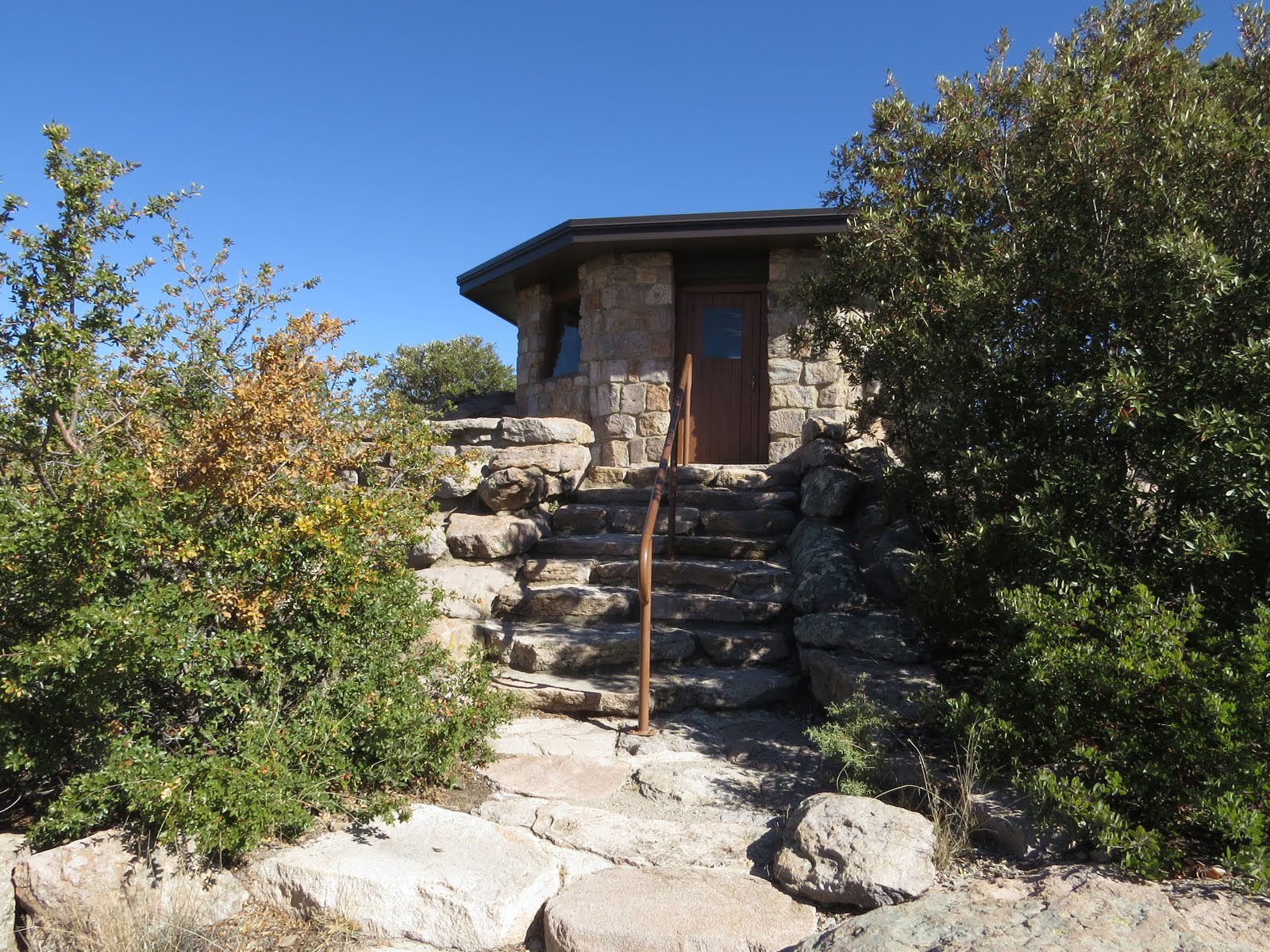
In addition to pit toilets at the parking area, there is a small exhibits building with 4 or 5 info-plaques inside sitting pretty much right on top of Massai Point

And if you are mobility challenged you can roll up to it on a paved walk that wraps around the back side,

but the rest of the nature trail is a little more challenging than that.

From the exhibits building you can look north to Cochise Head, about 4 miles away and 1000 feet higher. It's beyond the boundaries of the National Monument but well within the Coronado National Forest.
Can you see the head looking straight up at the sky?

If you look real close at the eye-socket, just to the right of that noble nose, you might be able to see a single eyelash sticking straight up

that's formed by a 100 foot Douglas Fir.

The geology of the Chiricahuas is volcanic in origin

and the resulting ash-formed rock has eroded rather spectacularly.

The nature trail is graced with well over a dozen easy to read info-plaques (often plaques are weathered to the point of illegibility.) that give the patient hiker a pretty well rounded picture of the area.

Another interesting feature of the trail is this little stone tower hanging off the southwest shoulder of Massai Point.
Perhaps it's not for the elevationally squeamish,

but if you make it up here this neat little contraption is waiting.
By pivoting the near end of the tube into the various saddles cut into the ring and looking through the tiny hole in the end, past a single vertical reticule at the far end,

you will be looking at whatever feature is described on the ring below the saddles,

such as this needle-like hoodoo called the Totem Pole that is 137 feet high and only 3 feet across near the base.
If you have limited time or constrained physical ability, combining the Massai Point Nature Trail, plus the drive up and down, with the Silver Spur Meadow Trail will give you a pretty well rounded picture of the Bonita Canyon area here in the Chiricahuas.
No comments:
Post a Comment