Monday, March 30, 2020

Going For The Daily Trifecta in Chiricahua National Monument


I'm going to squeeze in my third hike of the day here at Chiricahua National Monument. You know, because my time here is limited and there's plenty of other hikes here to save for next time.

This one will be the Lower Rhyolite Canyon Trail. The one highlighted in yellow. A relatively straightforward trail up the lower end of Rhyolite Canyon and, hopefully, back down again.

OK, OK.  By the time I finished the Massai Point Nature Trail and the Echo Canyon Loop hike,  drove back down the mountain to my campsite, and hiked the half mile to the Lower Rhyolite trailhead, which is at the visitor center, this wasn't so much a hike as it was a race.

But what can I say?  In a moment of male-inspired simple-mindedness I totally succumbed to the egocentric siren call of checking off one more goal just so I could say I did it, despite the fast-approaching sunset.

Yes, yes, I understand the apparent hypocrisy of attempting this hike just after spouting off about the need for hikers, especially solo hikers, to take responsibility, but let me point out that I am taking responsibility. Instead of relying on the sheer dumb-luck of stumbling across somebody out there so I can ask if this is the way to the parking lot or calling for help if I get myself stuck, as always I'm carrying the tools needed to keep hiking after dark, and even the equipment and clothes necessary to hunker down where I am and wait for daylight if I have to. By planning for eventualities like this not only am I prepared, but because I think about what can go wrong, it's less likely to go wrong. (At least it seems that way to me since I have a lot of just-in-case things in my pack that I've never had to use for real, just for practice.)

Besides, none of us can guarantee we will even have a next time, and at my age by the time I get around to the next time there's a good chance I won't be as active or have the stamina I do today. At least that's the excuse I'm using right now to justify this ego-driven last hike of the day.


The visitor center end of the Lower Rhyolite Canyon Trail is a bucolic take-the-family-out-for-a-picnic setting there under the trees alongside the creek,


but in it's mile and a half length (one way)


this trail climbs just about 600 feet

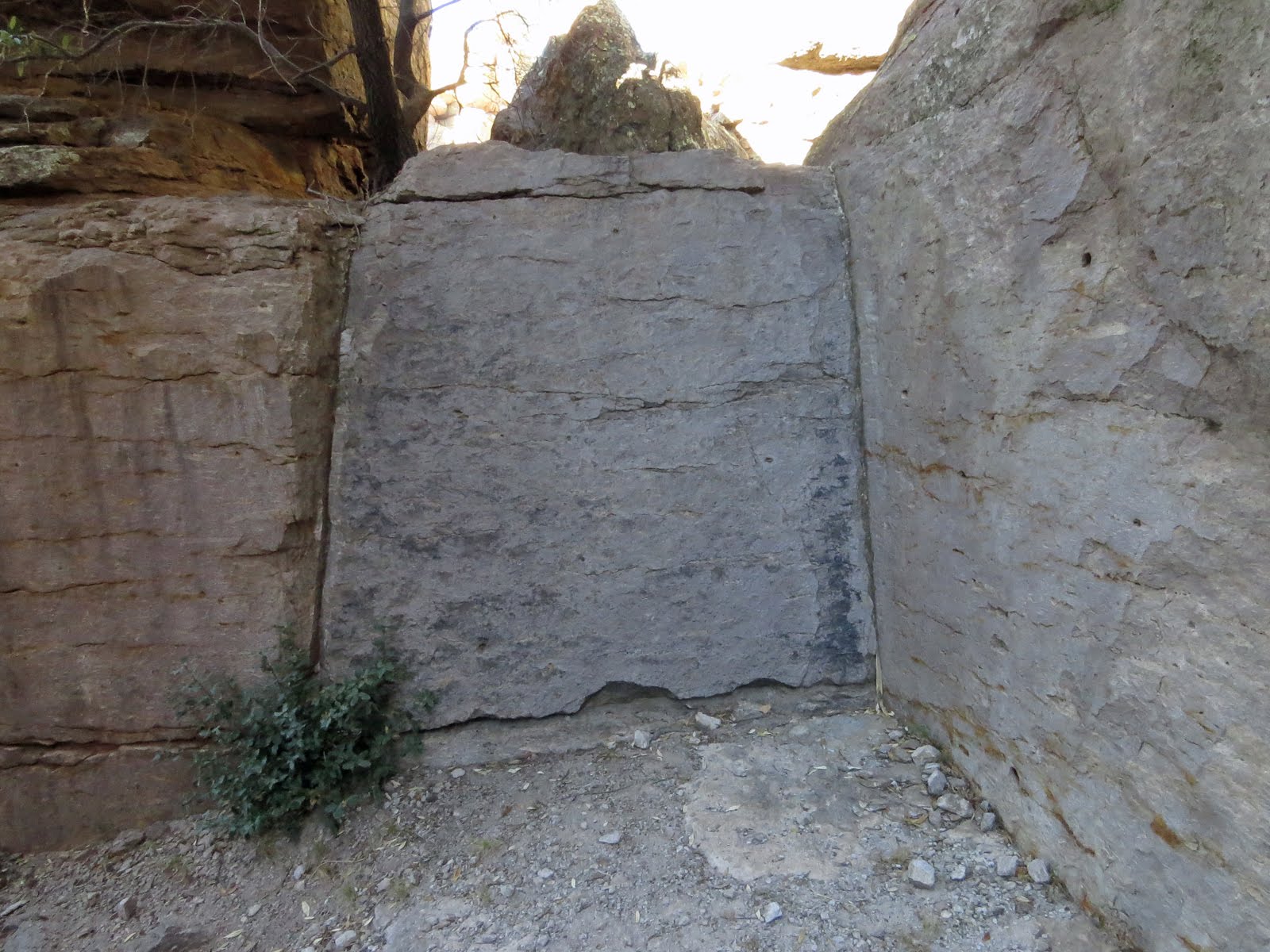
Yep, if you let your eyes adjust to the shadows, there's a trail there.

as it heads up through forest along the south flank of Rhyolite Canyon to where the Sarah Deming Canyon, and trail, splits off to the south.


But the sun is getting low and I only have an hour and a half before it sets on me all together.

That means, if I give myself a 10 minute "safety" cushion, I absolutely have to turn around in 40 minutes, even if I haven't made it to the other end of the trail, so I need to get a move on.

Compared to my normal hiking pace of as little as one mile per hour, I'm going to have to really hustle, definitely making this last hike of the day, one more than is perhaps prudent, more about ego than experiencing the area.

But, in an homage to ego, I was determined to make it and set the timer on my phone and set off.

The big question is, after a full day of hiking already, do I have it in me to climb 600 more feet in 1.5 miles before the countdown ticks off to zero?


And even if I manage that, I still have to make it back down that same mile and a half in another 40 minutes if I'm going to avoid getting caught out here after sunset. And though I carry a headlamp with spare batteries at all times when hiking, I really don't want to have to use it. . . (True, once down I still have a half mile to go to get back to the campsite, but I can do that on the road and walking a road after dark is much easier than a trail.)

I mean, have you ever hiked in pitch-black down an unfamiliar trail with nothing but a little pool of red light to hold back the scary monsters that are out there?! I have, for practice, and it can be - well - scary! (The white mode of a headlamp casts a wider, brighter pool of light, but that just makes it scarier by taking away any semblance of night-vision.)


But right now I've got daylight to work with.

Right now being the operative words.

As I climb I'm keeping a close eye on those shadows across there on the other side of the canyon.

The speed at which they are lengthening is worrisome. So worrisome I spend some of my precious time rechecking the almanac on my phone, which just barely has a signal here, to verify that I got the time of sunset right.

I did, but I clearly need to get a move on . . .


After a ridiculously fast trip up the trail, which my body handled much better than I expected, though I have to admit there might have been a touch of adrenaline fueling me along, I made it to the upper end of Lower Rhyolite Trail with 3 minutes and a few odd seconds to spare before reaching my have-to-turn-back time.


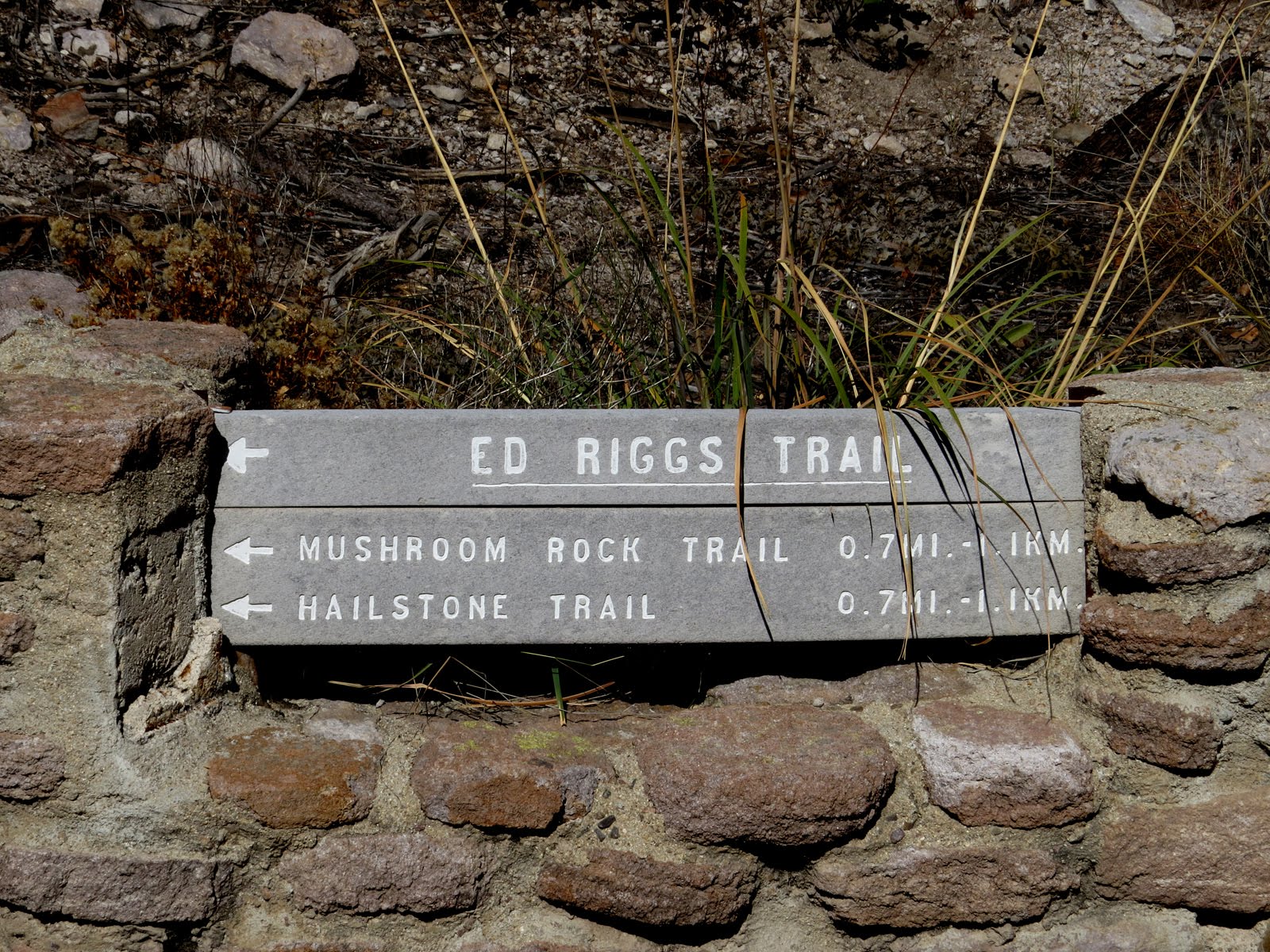
Lower Rhyolite Trail is sort of the gateway to hiking the higher elevations of Chiricahua and there's a lot going on at it's upper end.


So much so that it takes a total of three


trail signs, 9 if you count by planks, to spell it all out.


This is as good a time as any to point out that the park offers a free shuttle service for hikers.

For much of the year they run a van from the visitor center up to the Echo Canyon and Massai Point trailheads. This way most of your actual boots-on-the-ground hiking will be downbound and you will only pass this point where I'm standing now once.

You would think the summer months, when they don't run the shuttle, would be the time it's most useful because riding the shuttle up eliminates most of the upbound hiking in the heat, but I don't make the policies.

To make sure you get a seat you need to sign up for the shuttle the day before at the visitor center. (And if nobody signs up they don't run.)

This is a nice idea, but the shuttle run isn't until 0900, which is a late start for someone like me who is ready to hit the trails at sunrise. . .


But now the issue is not sunrise, but rather sunset.

I've burned up my 10 minutes of cushion-time taking photos of the trail signs and catching my breath, and now the sun is so low the shadows of those rocks over on the other side of the canyon are running up the canyon wall


so, after a wham-bam-thank-you-ma'am kinda visit, I need to get myself back down off this mountain!

What the hell was I thinking?! is what I wondered as my legs ached and my lungs heaved. Instead of speed-walking down this mountain with 25 pounds of gear on my back in the fading light I could have been kicked back in a comfortable chair at camp with some cheese & crackers and a good book!

OK, no pictures, (I tried but it was too dark for my somewhat basic camera) but on the final stroll from Visitor Center to campsite, down the trail rather than the road because there was still enough twilight, even under the trees, to see where I was putting my feet, I was reminded of exactly what I was thinking when I discovered I was sharing the space with two does and a buck. Though it was too dark to tell if they were Whitetails or Mule, for a few moments we peacefully coexisted there in Bonita Canyon.

Sorry Sargento and Ritz, but that beats cheese & crackers in camp any day.


Monday, March 23, 2020

Personal Responsibility, Hiking Smart, and Maps!


The first time I wrote this particular post it came out as - well, what most might be inclined to call a vicious rant.  Probably because as I was writing it (mid December 2019) a volunteer search and rescue team member had just died on California's Mount Baldy while trying to find a missing hiker. A hiker that had made a personal choice to continue on as the rest of the group he was with turned back because of what they deemed to be life-threatening winter conditions. I have little tolerance for unthinking stupidity, and and even less when that stupidity costs others.

But after sleeping on it I decided I should tone the post down a little, so here's the gentler, more refined version.

What triggered this post wasn't that incident in California, (That hiker went missing Dec 8, on Dec 15 the search was called off, and as of right now he is still missing) but instead it was instigated on a more personal basis in mid November (2019) by a lone hiker coming down the Hailstone Trail towards me as I was working on the second half of the Echo Canyon Loop hike in the Chiricahua National Monument.


As she approached, instead of the usual walk-by "how's it going", she stopped me and asked if this was the way to the parking-lot.

Well it was, sort of.

If, about a half mile further on, she diverted onto the Upper Rhyolite Trail she would be headed for the Lower Rhyolite Trail and from there, the visitor center parking-lot.

But somehow, even though it was afternoon by now which made the timing right, she didn't strike me as the hardcore type of hiker that would have come up from the visitor center on foot, made the Big Loop, and would be heading back down towards the car about now.

Maybe it was the flimsy, brightly-colored cloth pack that looked like she bought in the toy department at Dollar General, or the fact that she was wearing ankle-socks and light-weight tennis shoes not really up to the rigors of this rocky, desert landscape. Regardless of what it was, I didn't take her for a serious hiker.


Not counting the lay-by for the Natural Bridge Trail which is only large enough for 2, maybe 3, vehicles, there are 4 different trailhead parking-lots spread out between the visitor center and the top of the mountain, so I asked her which parking-lot she was trying to get to.

Turns out she didn't know. . . (OK, first she asked if she was going the right way, and now it turns out she doesn't even know where she's trying to get to!  Not a good sign. . .)

After some discussion over the paper map, given out for free at the Visitor Center, that I pulled out of the the thigh pocket of my cargo pants we determined that she had parked at Echo Canyon, which meant she was currently going the wrong way.

The trails in Chiricauhua National Monument are well marked at intersections, but on their own these markers are not enough information to keep a person oriented.
It also takes a trail-map to fully interpret where you are and what direction to go.

During that discussion she admitted that maybe she shouldn't have left her map in the car!!!

D'oh!

I'm pretty proud of myself that I had enough self-control to tamp down that impulse to reach out and give her a dope-slap up-side the head!

Then again, it's not my first trail-encounter with the stupid, the irresponsible, the self-centered, and the just plain clue-less, and based on the evidence, it won't be the last.

In this case it happened to be a woman, but over the years I've encountered roughly an equal number of female and male solo hikers out on the trails and I have to say, of those that were in over their head, the men are leading the count.


Solo hiking carries a level of risk with it, and there is a covenant, albeit a clearly all too often unspoken covenant, between those that choose to take on that risk and society in general. A covenant, implied or otherwise, that dictates they will hike responsibly.

That they won't unduly depend on, or otherwise burden, that society over a choice they made of their own free will.

Clearly hiking an unfamiliar area without something so basic as a map is an egregious breach of that covenant!

Not to mention that it's just plain stupid.

Unfortunately this is not the first time I've encountered lost and map-less hikers.


Go ahead and call me overly cautious if you want to, because after hundreds of successful (Well, mostly successful but of those few that weren't I managed to extract myself without outside help, so I guess that kinda makes them successful too.) solo hikes over decades I'm fine with that label, but at a minimum, in addition to the paper map that's always in the thigh pocket of my cargo pants, I hike with a GPS (which obviously has a map on it) set to tracking mode so I not only know where I am but also have the track of how I got here, as well.

If I can't get my hands on a paper map I have been known to photograph maps at trailheads with both phone and camera (Never depend entirely on a single bit of electronics! Sometimes that shit breaks!) or even to hand-draw a map of my own.

As I said, that's a minimum.

Today, though she is carrying no map whatsoever, I have a paper map as well as a trail guide in my pocket, the GPS clipped to my pack with spare batteries ready, and


an electronic copy of the paper map as well as the two relevant USGS Topo maps downloaded onto my phone. (By having at least two electronic devices, GPS and phone, I greatly increase the likely hood that at least one of them will be working and paper maps don't break, just as long as I don't set fire to the thing or accidentally eat it.)

By the way, all the maps, paper and electronic were free, (Of course I had to buy my GPS) so I don't think there's any excuse for not having them, but a web-search on "missing hikers 2019" turns up a distressing number of hits.


Because of limited District Office hours and funds, it can be difficult to get paper maps for trails in National Forests, so while I have a decent internet connection I go to the Interactive Visitor Map,
zoom in on the area of interest, and screen-grab sections of the map to put onto my phone as a PDFs. Now they are available even when there is no cell service, which I find is still the norm in the National Forests and not the exception.

Note that this particular Visitor Map only covers National Forests and does not include other National facilities such as Parks and Monuments. For those maps I go to the particular facility's web site.

There is a similar map for BLM lands called the BLM Recreation Web Map but it is painfully slow and has limited information. There are clickable points, some of which will include a web-link to a specific area, but it takes patience for these clickable points to load into the map. (If the resulting popup says 1 of (several) the link may not be on the first popup.) Often the most this map is good for outside of these few specific points of interest and the general location of some of the major trailheads is to show boundaries of BLM lands.

Like the Forest Service map, it is only available on-line so I grab screen-shots of areas of interest while I have a connection.


While I'm on-line and prepping for a National Forest stay, I'll also get an updated MVUM (These can change from year to year because of fires, slides, and over-use, so checking for updates is prudent.) for the forest I'm interested in. These are also PDF's that can be downloaded directly to my phone. One place to find them is at this National Forest site.

But, as we've come to expect with all things government, finding your map here is not fool-proof. For instance you will find no mention of Coronado National Forest at this particular link. Then again if you go to this Coronado NF site you can not only find Coronado NF MVUM's, but, illogically, also come up with links to hard-to-find MVUM's of other locations such as Gila NF.

Go figure.


They don't always show the trails, even long established trails, but I also like to have a proper USGS topo for the area I'm going to be in.

For those I go to the USGS store


then zoom in on the map until I locate the area I'm interested in,


click on that spot to get the blue teardrop, (Sometimes it takes several tries to get the blue teardrop.) click on the teardrop then click on the View Products button.


This opens a new, scrollable pane over on the right side of the screen listing all the USGS maps for that spot. (And farther down the list, maps for the 8 adjacent squares as well.) Usually the map I'm interested in is at the top. The most recent geospatial PDF 7.5X7.5 grid, 24000-scale map.

The $15 is for if I order a paper version. By clicking on the View PDF button, for no charge the PDF version will download and then I click on File > Save As and move it onto my phone.


A final, hail-Mary type of trick I use when I know or suspect there may be no service available where I'm going, is to open Google Maps on my phone while I still have service, then pan and zoom around in the area I'm going to be. Though this is more relevant to finding my way around a town than hiking a trail,


Later, as long as that's the last thing I did on Google Maps, I can open the app and data for that last area I looked at will still be there in the app, even when I have no service and have stopped the Maps app in between.

There won't be any clickable points or traffic data, but I can still zoom and pan around within the confines of the "remembered" area. (Things are just blank if I go outside that area.)


The point is, there is no excuse these days for wandering around, especially in the back-country, without proper maps.

Frankly I don't really care if the people that choose do so despite all the resources available to them get themselves into trouble, but it twists my knickers when it takes my tax dollars or, in some cases, someone else's life, to then get them out of trouble of their own selfish making.


Monday, March 16, 2020

Hiking Echo Canyon in the Chiricahuas


For my second hike of the day in Chiricahua National Monument (OK, I'll admit that first "hike" barely qualified as such, but I did put one foot in front of the other for about a mile so I'm counting it anyway.) I picked the Echo Canyon Loop because it sounds cool. As does the Natural Bridge Trail, and the Heart of Rocks Trail, and the - - Nope, nope. I've made my choice, I need to stick with it.

The Echo Canyon Loop consists of linking three trails together, plus, in my case, the spur up to Massai Point at both ends of the hike, though a smart person could avoid that last little bit if they parked at the Echo Canyon trailhead instead.


The trail guide, that can be picked up at the visitor center, calls this a 3.3 mile hike, but once again I somehow made it longer than that and by the time I got back to The Van it was more like a 4.4 mile hike.

From Massai Point this hike had me dropping about 600 feet of elevation (Which would have only been 500 feet if I left from the Echo Canyon trailhead) which I then had to recover again. (Although there is another option that I will get to in a later post.)

By hiking this loop counterclockwise I faced the steepest parts of the trail, which really aren't all that bad, on the downhill trek and the uphill return was a more gradual, steady pull because it was spread over a longer distance.

The cliff-hugging trail not long after leaving Massai Point on my way towards Echo Canyon

OK! Enough talking.

Time to get hiking!

At the bottom of the one hundred foot drop down Massai Point spur (Although I'm going to gain 50 of that back by the time I'm halfway to The Grotto)


 I ran into an intersection and this trail marker.


I was going to be hiking the Hailstone Trail, but not until on the way back, and the Mushroom Rock Trail would have to wait for another trip, so I ignored all those tempting arrows and went right instead.


As you can see, it turned out to be a beautiful, if crisp, day for hiking.


The geology here makes for some interesting formations such as Mushroom Rock, Big Balanced Rock, and Duck on a Rock. (I'm sensing a rock theme here. . .)


I'm sure this one has an official name too but I don't know what it is so I call it hungry Chickadee because it looks like the one of Chickadees impatiently waiting for me to finish refilling the feeder,


and I call this one Don't Sit Under That Rock!


That's Sugarloaf Mountain out there on the right. It stands another 400 feet higher than Massai Point


and has a CCC built lookout on top that is used for monitoring lightning strikes for lingering smoke during the summer.

And yes, there is a trail up Sugarloaf but that's also a hike for another trip.


About a half mile, a strong half mile, from the Echo Canyon trailhead are the Echo Canyon Grottoes.

I managed to arrive there just in time to catch a nice warm glow coming through the cave-like passage on the right,


but I also caught up to 5 or 6 people of my age or slightly more also poking around the Grotto.

If you have some physical/stamina limitations the Grottoes could still be an attainable destination. The hike here and back isn't all that long and the Grottoes are at about the same elevation as the Echo Canyon trailhead with only a mild hump in between.

Unfortunately those people that I caught up with were scrambling and lounging around the nooks and crannies of the Grotto for what seemed like forever, preventing me from getting any decent shots of it without looking like some snooping pervert, so I guess you'll just have to go see for yourself.

Fortunately, even though it was still relatively early with plenty of daylight left for hiking, every one of those 5 or 6 must have chosen the Grotto as their destination and turned around instead of following me on down the trail, because I never encountered them again.


It's that time of year (This was mid November) and I heard these migrating cranes long before I finally managed to spot them flying at well over 10,000 feet.


But my main focus was more terrestrial.

I call this Child After a Long Day at the Zoo,

which sounds better than Lazy Bastard, which was my first thought.


And the hiking did require some terrestrial focus because a little while after leaving the Grotto behind the trail got steep-ish. Let's see, there's 1,2,3,4 - oh hell, a lot of switchbacks, many of them short and tight,


to get down through the terrain here.


At one point I could see the official spot of this trail's namesake down there,


but before I could get there


I first had to get through


the section called Wall Street.


I tried pressing in a few strategic places while uttering magic words, but wasn't able to open this very-well fitted door.  So I'm still wondering what's behind it. . .

(Should have put one of my hiking sticks out there for scale, but this thing stood well over my head.)


Because of the rugged and corrugated nature of the canyon walls there wasn't really much in the way of echoing going on down in Echo Park, especially for an introvert who is pathologically adverse to making loud noises,


 but I didn't mind in the least.


I had the place to myself except for this alligator wearing a silly Marge Simpson hairdo and banging, silently, on a big bongo drum.

Nice place for a lunch-break!


Which seemed to draw out a few


of the local residents.


From here my return trip is up Rhyolite Canyon on the Hailstone Trail


which, in contrast to the trip down here, is a steady and more gradual climb


back towards the heights that I came from.


Turning around and looking west towards the visitor center, I could see all the way across Sulphur Springs Valley to a little piece of the Dragoon Mountains some 40 miles away, the scope of the view narrowed and focused by the canyon.

I'd be over there in the Dragoons soon enough, but for now there's more of Chiricahua to see. Though campsite availability is putting a serious crimp in how much time I have to see it.