Monday, October 31, 2022

Lake Catherine State Park

 Now that I'd already made a few stops along the way during the 2022 family reunion trip I was feeling kinda like a crack-whore.

I couldn't quit!

Rather than seeking help for my addiction, while still knocking the Illinois trail-dust off my hiking boots, even before leaving Little Grand Canyon, I was doing some research.


Entry to Arkansas State parks is free to all, resident and non, and there are 52 of them to choose from. BUT! The offerings lean heavily towards golf-courses and archaeological sites.

I don't golf, and while archaeological sites are interesting, as a persistent hiker the short paths around most archaeological sites fall seriously short of my definition of trail.

Fortunately the state maintains a comprehensive and easy to use, map-based website of its state parks.

Click on one of the parks on the map and that park's own website pops up.


Such as this one for Parkin Archaeological - Which right there on the front page told me that this site covers all of 17 acres so hiking opportunities are probably pretty limited.


But with some diligent clicking I managed to find Lake Catherine State Park (The red arrow a few maps back) with over 10 miles of trails.


And a little after 0900 on a Friday morning I was rolling into the park.


In addition to pavilion, boat-ramp, a variety of cabins, and a primitive tent area, there is also a 70 site campground, some full hookups, (50Amp) some water/electric. (30Amp)


Many of the sites back right up to the water, but be aware that there is a natural-gas fired power plant across the lake.

It didn't seem to be too noisy, at least during the day, but I wasn't there in the dark so I have no idea how brightly it is lit when the sun goes down.


But for today my interest was in the hiking, not the camping.

To that end I stopped by Visitor Information to pick up a trail map.

- - - Yeah - that didn't go too well - - -

The only printed map available is the tiny little inset down in the bottom corner of the park brochure, the same one on the park's web site.

And they couldn't even get that right!


The three trails are fairly well paint-blazed, 


but on the diminutive little bit of paper map they printed up in the brochure they obviously couldn't be bothered to use corresponding colors. In fact they actually confused things by miss-using red, which is the actual blaze for the Falls Branch trail but on the map is used to mark the Horseshoe Mountain trail.

Trail                         Actual Blaze        Map Marking

Dam Mountain                 White         Blue
Falls Branch                     Red            Purple
Horseshoe Mountain        Yellow        Red

I suppose that's indicative of today'a pride of workmanship, or rather lack there of.

Oh well - let's just go hiking!


First up, since it looked like it might be the most exposed in terms of heat later in the day, (It was still August when I was there) was Horseshoe Mountain Trail.

A check of the topo clearly shows how this mountain got its name, and other than the approach and departure its namesake trail follows the horseshoe-shaped ridge-line of the mountain.

Yep. That's the trail there in the middle of this photo.

According to my GPS track the published distances for the trails in this park are remarkably accurate, but because of the terrain up onto and down off of the mountain, as well as across the saddle at roughly the halfway mark, this trail hikes as a pretty long 3.5 miles.


The micro-clime of much of this trail is fairly arid, but along the way there are views down into the lushness below.


After wrapping that trail up and taking a short break at The Van, I took on the shorter Falls Branch trail.

Semantics are important here.

On the trailhead placard this trail is listed as the easiest of the three,


but they don't actually say it's easy

The climb up towards and then back down from the saddle that must be crossed there in the center-left of my track requires some rock-scrambling,


switch-backs, and a few bridges and stairways. (one of the stairways is out there in the distance of this photo)

Twice I had to pause and step off the trail when people out in front of me (It's Friday afternoon and the park is starting to get busy) gave up and turned around to go back. (The dog member of one of these groups looked mighty relieved as he went by headed back towards the trailhead!)


Part of the problem here is that this sign, which sits at the end of the short spur leading in from the trailhead to the intersection of all three trails, is incomplete.

Again, lack of pride in workmanship.

You wouldn't know if relying on this sign, but both the Horseshoe Mountain and the Falls Branch trails also loop around off to the left at this point, and if you are only going as far as the actual falls, which seems to be the main draw here,


going left, where no arrows point, means following a segment of easy, flat trail


that sticks to the shoreline.


Oh, and the falls?

This is a publicity photo of the falls. I have no idea when it was taken.


This is my photo of the falls.

To be fair, there was a small trickle still running over the edge. Enough to entertain those kids down there at the bottom.


And over there on the other side of the falls is the beginning of the Dam Mountain trail marked by the double blaze.

But by this point it was getting well on into the afternoon. Too late in the day to be tackling that, the longest and most rugged of the three trails.

So I'll save that one for another day.


OK, I'm still 10 or so road hours from home, so where's the next stop on this trip going to be?!

To be honest, I was getting pretty far south by now and any further stops would be even farther south. With a heat index of 105 it wasn't exactly chill today, (August 19) and it wouldn't be any better tomorrow, so, with one more rest-area overnighter a couple hour farther down the road, I finished up the trip home the next next day with no additional hiking in between.

Quitting cold turkey is hard!


Monday, October 24, 2022

Revisiting the Scene of the Ambush!

 OK. I'm on a roll now!

After leaving Turkey Run State Park in Indiana, for the second time this trip, I made it to the I-57 Kent Lake Rest Area in Illinois in time for a leisurely dinner while watching the last of the daylight fade over the lake.

With the light gone I retreated to The Van and checked out my maps. I noticed that I was only an hour and a half from Illinois' Little Grand Canyon and since I seemed to have this theme going of stopping off along the way on this trip I thought why not!

So fairly early the next morning I found myself in this little corner of the Shawnee National Forest. But, now that I was actually here I was having a few second-thoughts.

You see, I was here before 5 years ago, and while it was a spectacular hike in its own way, it didn't go quite as well as it could have.

That time Mother Nature caught me not paying attention at a tricky spot on the trail and bitch-slapped me to the ground. - HARD!


Just like a fellow blogger I follow when his bike skidded out from under him on a turn, I landed on the right side of my hip. Unlike that other blogger, I somehow didn't need to get a new hip installed as a result. But it was still a sobering, and painful, incident.


But, with more macho bravado than sense, I settled my pack into place on my back this morning  and set out anyway.

Clockwise around the three and a half mile trail this time. (I did it counterclockwise last time. Always good to mix things up!)


Mother Nature quickly gave me one more chance to come to my senses by throwing a tree across the trail in front of me,


but she also threw a symbol of nimble-footedness in my path as well. You know - the mythical Mercury and all - that fleet-footed trickster with his winged hat who was always pushing the boundaries.

I chose to ignore the first omen, the massive tree blocking the trail, and believe in the second. Although there was no flying over that tree! Since it's larger than it looks in the photo, I had to pick my way around the obstruction, glad that I knew enough to slather on the bug-juice in this chigger-laden part of the country as I pushed a new path through the brush.


Last time I was at this overlook it was severely overgrown, especially out in front where vegetation blocked most the view, so there wasn't much over to look.

This time it has been carefully trimmed back, opening up the view a little more,


and the placard renewed.


Up until now the trail has been pretty civilized, but that was about to change and I was given one last chance to do the sensible thing.

- I didn't -


At first the going wasn't too bad,


But it didn't get any better


and pretty soon everything was going downhill - in a hurry!


It was time to strap the grippy-spikes onto my boots and remove the rubber covers from the titanium tips of my hiking sticks, (Actually the covers are supposed to be used just for transporting the sticks to prevent stabbing anything but I don't like the noise of the constant tick of titanium striking ground so I leave them on all the time - OK, most the time.)


because when faced with terrain like this I'll take all the help I can get! (Yep, I came from up there.)


The going was slow, partly because that's what the conditions demanded, partly because flashbacks of that previous fall kept getting in the way, but I managed to make it down to the floor of the canyon with no spectacular mishaps.


The lighting down here was different this time. But I wouldn't call it worse, in fact in some ways it was perhaps better.

Last time this shot was of sunlight slashing diagonally through a drifting mist. Atmospheric and mysterious, but moments like that are, by their very nature, ephemeral at best,  

and by keeping my eyes open and taking my time I still managed to find a few gems of nature and lighting down here in the bottom of the canyon.


But frankly the easy-going canyon floor doesn't last long


and soon I was faced with climbing my way back up out of here - right past the spot where I crashed and burned last time. (OK, more like thudded and moaned, but you get the idea.)

And I'm not sure what the deal is with the cairns. It's not like there was any other way to go.

Obviously I made it, and with no additional bruises or injuries. (Maybe I am getting smarter in my old age!)

Though interesting, this is a small spot with no camping on site, a single, relatively short 3.5 mile trail, and not much else going on, so I'm not sure it qualifies as a destination in and of itself, but if you happen to be passing by it's not a bad place to check out. 

Monday, October 17, 2022

Turkey Run All Over Again - Sort Of

 After a couple weeks of visiting family up in Michigan it was time to move on because - well honestly, kinda like green beer and arsenic, I'm best if taken in small doses. (Just ask The Wife!)


But with my adventurous nature all stirred up (Is that a side effect of arsenic? I know I haven't been drinking the green beer!) I decided another stopover, maybe a little more leisurely stopover this time, at Turkey Run State Park on the way home was in order.

With that in mind my target for the first day's run was the Crawfordsville Walmart.

After a leisurely morning chilling with The Sister - the retired one - I headed out and got to the Walmart shortly before sundown (RV's and trucks are encouraged to use the east side of the parking lot opposite the auto care area.) and it put me only a half-hour or so from the State Park which meant I could get an early start on my second visit to this place.


According to the web-site the park opens at 0700.

I rolled up to the stop-sign at the gate-house with my $9 in hand at 0710.

There was no one inside.

I thought about it for a moment, then drove on in anyway because daylight was burning and it's not my fault they can't get out of bed on time.

I tried the park office just beyond the gate-house but it was also closed - as was the Nature Center.

Oh well. I dug the previous visit's receipt out of the recycling pile, threw it haphazardly on the dash, which is pretty high up on a Sprinter so it's not easy to read the small print, such as date issued, from the ground, then went on about my day with only a slight dent in my conscience. 


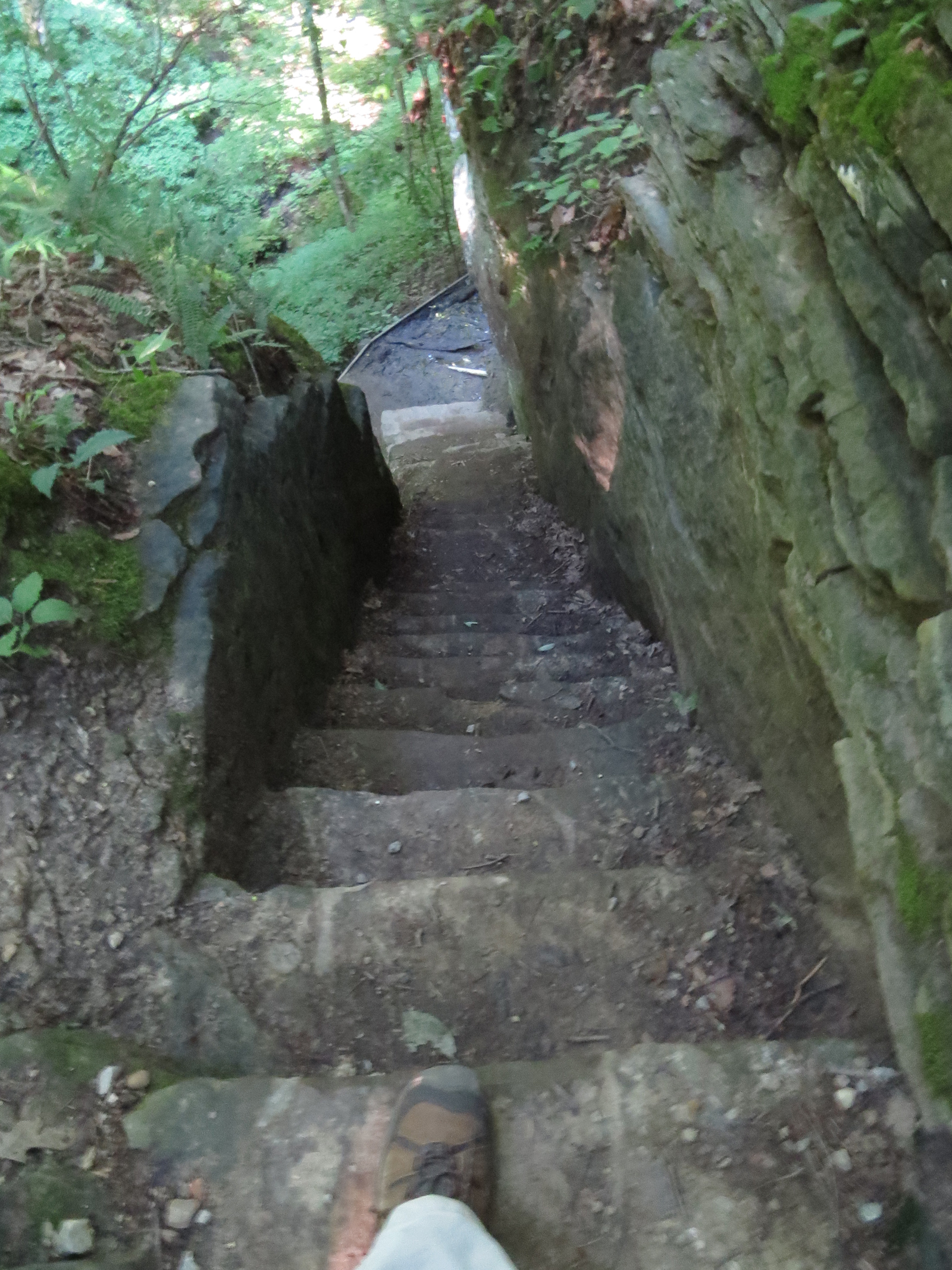
First order was to climb back down the 70 steps to the riverbank, but instead of crossing Sugar Creek on the suspension bridge like last time


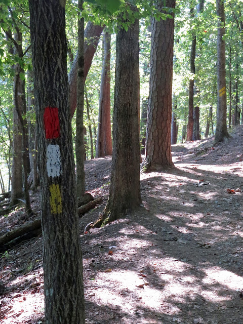
this time I hung a right and followed Trail 1 along this side of the river, working my way east towards the rising sun and the covered bridge.


I immediately went past what I can only assume, since there was no information to be had, on map or placard, is - or was - some sort of pumping station, .


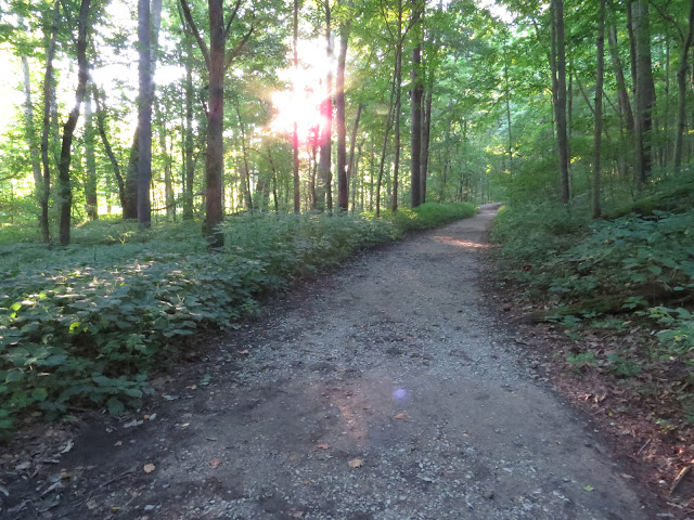
It was a very nice, refreshingly private, stroll


along the creek (River to those of you that live further west)


through dew-beaded vegetation,


past incredibly lit vignettes,


and around the nose of Goose Rock - which is actually a part of the bluff overhead that has fallen off, so keep your ears open for the sound of rock cracking!


Along the way there are picturesque glimpses of the first real destination of the day


and it wasn't long before I was at the covered bridge that has been supplanted by the concrete upstart that now carries the county road across Sugar Creek.


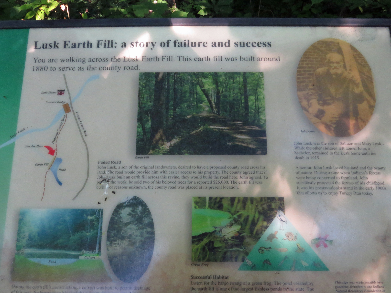
Next stop was the Lusk Landfill.

To get there I went south a little ways on Trail 2, which I was going to take anyway in order to make this a loop hike instead of an out and back.

Since the photo of this placard is difficult to read unless blown up, let me fill you in on what it says.

In what is clearly another example of petty men who think they have power screwing over the 'little people', in 1880 John, the reclusive son of Salmon Lusk who originally settled the area, wanted easier access to the family home. The county agreed that if he built an earth-fill across a challenging ravine the county would build a road across the top of it. John sold two of the virgin-timber trees he dedicated his life to preserving for $25,000, that's about 3/4 of a million in today's dollars, and used the money to have the fill constructed. Only to have the slimy little county officials reroute the road around the fill anyway.

OK OK, So that's not exactly the way it's put in the placard but I see nothing wrong with calling a slime-ball a slime-ball.

But the joke is on those despicable little men and their power-games because the fill has created a valuable wet-land habitat that John probably would have been much happier with than a road anyway.

Today John Lusk is known and celebrated for his conservation work while the names and non-accomplishments of those government thugs have been long forgotten. 


Just in case you might have been lured into thinking this side of the river is less rugged than the other,

this segment of Trail 2 passes through Gypsy Gulch


and Box Canyon


before returning to the more placid terrain of the parking lot near the Nature Center.


After a quick snack back at The Van I took off hiking again. In the other direction this time.


I thought this was going to be a kinda gentrified stroll along the Lieber Tour,


 to check out the 1920 Turkey Run Inn which is still operated by the park system,


the 1850 Lieber cabin constructed out of huge slabs of old-growth Tuliptree logs


up 32 inches wide,


the Juliet Strauss memorial celebrating a journalist and equal rights advocate that also championed preserving Turkey Run,


and the Lieber Memorial - Richard Lieber was a key figure in the entire Indiana park system - which, sitting in a quiet nook in the woods,


overlooks a log church - that's the shoulder of his memorial in the bottom left - that he saved and had moved here.

Descendants of the original congregation that donated time and materials to build the church in the first place still meet here once a year.


And I was partially right - you know, about that whole gentrified stroll thing.

But then I thought I might as well hike the loops of Trails 6 &7 while I was here at this end of the park


and while doing so take a detour to check out the campground.


Well things got a little less gentrified in a hurry!

Here I'm standing at one end of the bridge that will take me from the Trail 6 loop onto the Trail 7 loop. 

See the handrail of the bridge peeking out of the foliage in the bottom center?

OK, now look up. See the wooden steps and railings up there at the end of that arrow? That's part of the Trail 7 loop.

That downed tree taking up the left side of the photo, in addition to partially blocking the bridge (I was able to push on through anyway) had landed on and crushed a portion of the Trail 7 loop into impassable splinters forcing me to turn left on the other side of the bridge instead of right and treat this segment as an out-and-back rather than a loop.


Similar to other areas of the park, Trail 7 along here is more of a creek in the bottom of a very steep gully than a typical trail.

And Trail 6 wasn't any different.


This bridge, with a glimpse of the Turkey Run Inn at the end of it, once carried the highway across one of the steep-sided ravines around here and now leads to the Lieber Memorial and church. (Up and around a turn out of sight behind me as I took this.)


This photo is hard to read - which is photog-speak for difficult to figure out what you're looking at - because I'm standing on that bridge shooting straight down - the top of the concrete railing is there across the bottom of the photo.

That diagonal slash in the bottom is the creek bed some 70 feet below. It's also Trail 6.


Turkey Run Hollow is also along Trail 6.

As I was climbing up out of here I ran into a woman from the philharmonic of Indianapolis. She was trying to find the hollow to scout it out for a potential, full-orchestra promotional video shoot. It would work great for that! But I don't envy some of the members trying to carry the larger instruments in and out of there!


Oh. And the campground?

Yeah, it's fine. Not great, but fine.


And big!


There are a handful of pull-through's but they are only located on corners where there wasn't enough room to squeeze in a 'regular' campsite, so may not be as big as some might hope for. The vast majority of the sites are back-in's and not all sites are suitable for giga-rigs, so if your rig is large careful selection of a site while making reservations is probably a good idea.

OK, By now I've managed to tramp nearly 8 miles and burn up most of the day. My next stop is only 3.5 hours away but it's already going to be touch-and-go whether I make it there before sundown, so I'm outahere.