Monday, July 27, 2020

A New Hike! And Posted Almost Real-Time!


OK, when I sit back and examine that post title it's sorta pathetic really to get so excited about something so mundane.

After all, I'm talking about a day-hike in a so-so location, not an epic adventure in a once-in-a-lifetime venue.

But through my personal corona-lens, it was a big deal!

Usually for me isolation is not an issue, in fact it's the norm, to the point where I never really thought much about it before except maybe when people used to remind me that I hadn't attended a single company Christmas party in the 31 years I was there. But sitting here in these strange times for the past half-year, tucked into my disease-fighting little fortress watching others dealing with the unusual situation through my on-line portal-to-the-big-bad-world, I've begun to question myself.

After all, while I'm hunkered down here behind the locked gate, suspiciously paranoid about every potential stranger-encounter, I've been watching one side of my family complain about masks and mandates and lost freedoms while going to back-yard BBQ's or on group camping trips, and posting group photos that are distinctly non-social-distancing approved. And even the more cautious side of the family have continued to get on with life by going, albeit fully masked, to work every day and playing in the golf-league once a week then afterwards gathering out in the parking-lot in a well-distanced circle for some 2020 style socializing. Cripes! Even Mom, probably the most isolated of us all in her community which has handled these times exceptionally well which we're so thankful for, had the community computer guy come into her apartment last week (First time anyone other than her as been through the door since February) to resolve some of the problems that have virtually shut down her ability to use said device. (Mom is kinda hard on technology. I keep telling her to stop stabbing the computer with her knitting needles but I don't think she listens. . .)

This has all made me do some serious questioning about myself and my fears, not so much my isolationist lifestyle, which I'm perfectly comfortable with - most the time -, but whether or not I'm still capable of going out in public at all after these last few months. On top of that there are a couple of family events screaming towards me over the next few months and, even if they don't happen, I may have completely lost confidence in my ability to go forth into the world.


So the other day I got on-line, used my Texas State Park pass to reserve and print a day-pass, (Can't do this at the park on the day like the good-ol-days since the office is closed)  and yesterday (July 22) drove The Van over there with mask at the ready and took a proper hike.

But don't let the GPS track of my 5+ mile hike there in that image above fool you.


This park, Bastrop State Park, is small and within constant ear-shot of the busy highway there along it's southern edge.

Oh, and now-days the town of Bastrop lurking there just to the west is just an overcrowded suburb of the cancerous sprawl that used to be "keep it weird" Austin so the number of trucks grinding up that hill over there is - well - a lot!

The only thing going for this location is that I didn't have to leave the house in the wee-hours to get there by the 0800 opening time since a sunrise departure would do just fine, and it had day-pass slots available at relatively short notice.

My preferred destination, Pedernales Falls State Park, requires leaving the house really early to make a day-trip of it, but has about 4 times as many trail miles, all well away from any developed spaces. But snagging one of the limited number of day-passes there on short notice proved to be problematic.


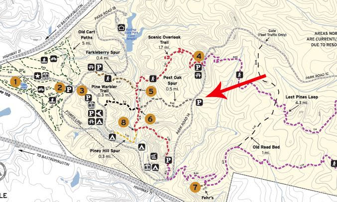
So, on this experimental foray out into the world, here I am parked in an overflow lot on the outer reaches of the Bastrop State Park trail system.

Not that the other lots were full, far from it, I just figured few would be interested in this small lot at the bitter end of the half-mile Post Oak Spur - or Grey Trail depending on which map you are looking at - and that's my kinda place, regardless of the times.


As you can see, it was a pretty overcast day, which is bad for photographs but for late July in Central Texas where, even without direct sun, it's in the high 90's - low 100's with humidity's to match, clouds-be-good! So I wasn't complaining.


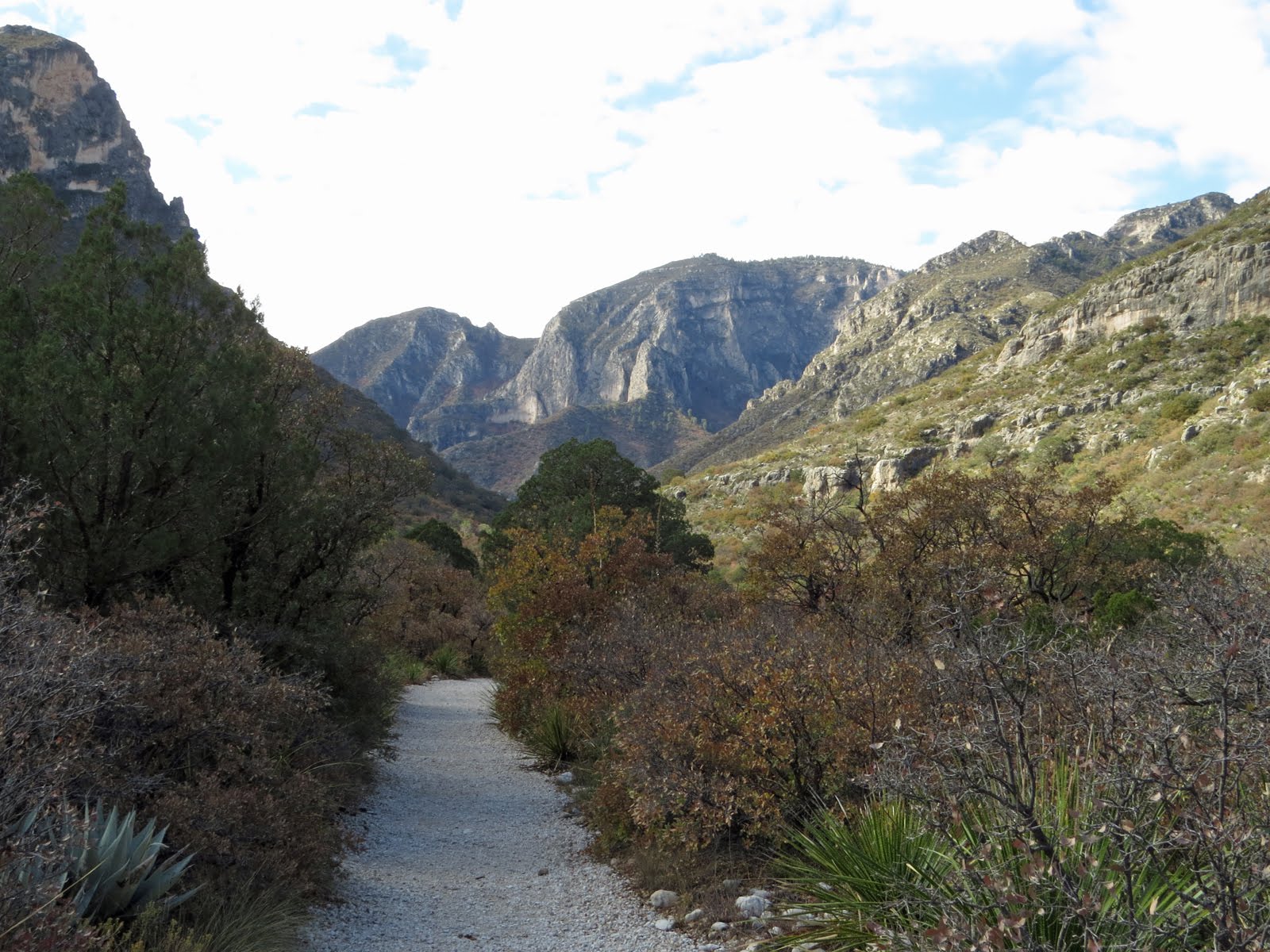
It's been 9 years since the Bastrop Complex fire went through the area, including most of the State Park, (The campgrounds in this park still haven't been reopened.)


and even longer since I've been here myself.


The 34,000 acre fire took out over 1600 homes and businesses as well as much of the park's stand of "Lost Pines", a more drought-tolerant variant of the Loblolly Pine so prevalent in East Texas.


But like it always does, the earth heals itself, and though there are still plenty of leftovers from the fire, such as some trails closed off for restoration work,


there are some nicely recovered areas as well.


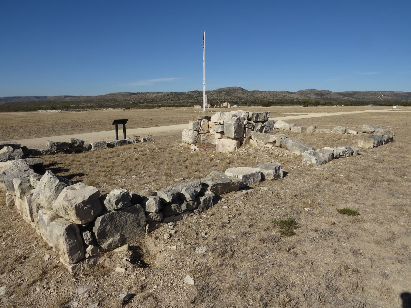
One unexpected thing the fire did was to expose a number of CCC projects that had been lost over the years under the vegetation. Most of these were fire-rings but there were also a few of these


elaborate drinking fountains built with the native sandstone and fed with a network of pipes crisscrossing the park.


Also built in the CCC era with the same stone, but never lost, was this shelter built on an overlook.


And given the temperature this nearby thermometer was shamelessly broadcasting as I neared the last third of my planned hike,


the cooler environment, easily 10 degrees cooler, under the shelter was a welcome break.


So, was my excursion a success?

Well, yes and no. . .

Bastrop State Park was certainly not my first choice of destinations, but I've met few hikes that were total busts so the hike part was, while not in the great category, fine in and of itself.

As far as getting myself back out in the world, I'm not sure just how much this day-trip pushed that agenda forward.

I drove from driveway to parking-spot to driveway with no stops in between. Talked to absolutely no-one all day. The closest I came to any person-to-person interaction was the un-masked dog-walker so embarrassed - or pissed off, I couldn't tell which - about being caught with the dog off-leash she went by where I had tucked myself well off-trail (With my mask on for the first and only time during the day) without even making eye-contact let alone small-talk.

Other than that I had the park, or at least my part of it, all to myself.

Which, on one hand, is a pretty typical day for me even back in "normal" times. On the other hand, I'm not sure this expedition did a whole lot to help me gain my go-out-into-the-world confidence back either.


One last little oddity before I go.

Along the half-mile Post Oak Trail - and only along that trail - for some reason every single burned stump had a rock-cairn stacked on top of it. I can't figure out why, and why only there. It doesn't seem to serve any restoration purpose and if it was rambunctious kids, well families and twenty-somethings are far more likely to park at one of the two main trailheads, and I saw nothing like this near either of those.

Oh - and I explained that self-contained water-brush, that thingy down in the bottom left, and the watercolor field-sketch kit I put together in another post. It's just that I've gotten posts out of order here and that one isn't scheduled for a while yet.


Monday, July 20, 2020

Running down the Numbers


I'm one of those people that likes to keep track of things. It's probably the engineer side of me. (And yes, I'm aware that it borders on being a disease.)

I keep spreadsheets for electrical usage and costs, monthly rainfall totals, water usage, (Yes, we are on a well but 10 years ago the county forced us to register our private wells. They haven't done anything with that register yet but I don't trust most people let alone government entities, so we installed a certified water meter of our own and have been keeping track ever since.) and a couple of other things I keep track of are The Van costs as well as trip costs.


That means I have a spreadsheet detailing  all the maintenance expenditures for The Van as well as each and every fuel-fill from mile 471, when I took possession of her, through to the latest fill-up at 82053 miles.


I also keep a separate spreadsheet covering the salient points of each camping trip I take in The Van.

During my Guadalupe Mountains National Park - Coronado National Forest trip I drove just under 2200 miles (That's about a 1000 miles less than one of my Michigan reunion trips) and spent just over $400 dollars all told. (I don't count food because I would have spent the same money on it at home.)

As is usually the case, the majority of that cost (>$300) was for fuel which would have been worse if I had been traveling in a "real" RV rather than The Van, which racked up a trip average of  20.83 MPG. (All-time average is 20.12)

The next biggest chunk was the $92.50 I spent on the 12 paid campsites I stayed in with the most expensive ($10 per night) being at Bonita Canyon in the Chiricahua National Monument and the least expensive, not counting the free boondock sites, were a number of $5 per night Forest Service campsites.

(If I was a RV park and resort traveler, figuring a modest average of $36 per night for a hook-up site, my trip-cost would have been jacked up to about $830 with site-cost taking the lead for largest chunk.)


In addition to my 10 gallon potable water tank I also carry 4 gallons of Berkey-filtered rainwater for drinking.

I start each trip with a full complement of water on board (This includes an additional 6 liters spread between my backpack and the four 0.7 liter water bottles I carry in The Van.)

On this particular trip I went through all four gallons of filtered water plus most of an additional gallon of bottled water I purchased along the way.


I also added 4 gallons of water to my 10 gallon potable tank during the trip. (Of course the tank was full when I started.)

For this, in addition to the traditional pressure "hose-fill" which I very rarely use, I have a gravity-fill in the form of a tube tucked up under the sink with a funnel cut down to fit tightly into its end. By the time I need to add water to this tank I've typicality emptied at least two of my filtered-water jugs and I use those to haul water for the tank.

Hauling water two-by-two allows me to carry a balanced load from wherever the potable spigot is back to The Van. (I once worked a job where we spent our days visiting various customer sites with heavy tool-bags and one of my coworkers screwed up his back by always carrying the bag in the same hand, creating an unbalanced load.)

By the time I got home I was down to about a third of a tank (potable water) and one partial jug of filtered water. (I always keep the backpack filled so it's ready to go as well as the four .7 liter bottles because, in addition to being my daily "drinkers", they also act as my emergency reserve, so all that stuff was still full when I got home.) So for the trip I went through about 5 gallons of filtered water and about 11 gallons of potable water.

Oh, and I didn't dump the 10 gallon grey-water tank until I got back home, at which point it was about 2/3rds full. (In addition to washing me and the dishes I use potable water for cooking and making tea so not all of the 10 gallons of potable water goes down the drain into the grey-water tank.)


I plugged into shore-power exactly - well - zero times.

Which isn't unusual. This trip I never stayed anywhere that I could plug in, but even when I do, I usually don't bother. The last time I stayed on a "hookup" site and actually hooked up was back in November of 2016. It was a Texas State Park with no choices other than hookup sites, and since it was cold and I had to pay for the electric whether I used it or not, I plugged in to take advantage of my small electric space-heater to take the chill out of The Van in the morning.

Even with a few shady (As in lack of direct sun, not shady as in sketchy neighborhood. . .) campsites thrown in to make things interesting, the 21 day trip was entirely solar supported.


As for the toilet - I never touched it.

My dedicated pee-bottle, (Eewww! Of course it's dedicated!) tucked in there on the right, got a workout, but all other business was conducted at available campground or public toilets, so my little portable toilet came back as clean and dry as when it left.


So there's my numbers for the Guadalupe Mountains/Colorado National Forest trip.

Not that anyone but me really cares. . .


Monday, July 13, 2020

Dancing with Ghosts at Fort Lancaster


November 23 2019


The Texas Historical Commission manages - well, I don't actually know how many historical sites they manage, but it takes a 170 page brochure just to list all of them with a brief description for each.

That brochure, which is free, also comes with the map shown above.


On the first day of this current trip, my trip to Guadalupe Mountains and westward, nearly 3 weeks ago now, I was making miles on I-10, you know, because this is a big state and I had a long ways to go, when I passed a small sign saying one of those historical sites was coming up, but only if I was willing to get off the big highway and take the scenic loop that originated at the next exit.

SR-290 is one of those roads that has been pretty much lost under the interstate out here, but little bits of it, like this one, survive by wandering off from the main route once in a while.

I'd had many hours since departure this morning to settle into a comfortable two-lane, 65 MPH rhythm out here on the interstate and was all geared up for a few more hours of the same, but on one of those wild-hair, spur-of-the-moment whims I found The Van wandering off along SR-290, lured by the promise of the little brown sign. And since The Van is my ride, i went along with her.


But by the time we actually pulled into the Fort Lancaster State Historic Site it was within an hour of closing time and I decided that just wasn't enough time to properly check the place out, especially since Historical Society sites are not covered by my Parks Pass and I would have to pay the $4 entry fee.


But three weeks later I was retracing my steps, or is that wheels?, back across the state and this time I got to the fort shortly after it opened.


Now I grew up in Michigan where forts were stockaded enclosures of wood with gun-ports and big massive bared gates.


Western forts, not so much. The "forts" out here tend to be collections of buildings, often spread out quite a ways, with no surrounding stockade. To me they have more in common with company towns than they do with the traditional forts or Europe and the Eastern US.

Fort Lancaster was situated along the southern route connecting the eastern part of the country with the west coast and sprawled out across more than 80 acres in the Pecos River Valley alongside Live Oak Creek about 200 miles west of San Antonio and 300 miles east of El Paso.


As I pointed out, though it is a state site, the Texas Historical Commission and the Texas Parks and Wildlife are two different entities so my Parks Pass was no good here. But the $4 entrance fee seemed reasonable so I paid anyway and, despite it being the weekend, had the place to myself until just before I finished up my tour.

(BTW the fee includes the use of a golf-cart to tour the fort if you don't have enough shoe-leather left to walk it.)

The visitor center was rebuilt about 4 years ago and includes a small but informative museum.


This is where I learned that modular homes were being carted around (literally) before the Civil War, though apparently they didn't impress. . .


This is a model of a Turnley Portable Cottage which was used as quarters for the soldiers,


until more permanent stone and adobe structures could be built.


If you look close at this remnant of one of the barracks buildings you can see the cut limestone blocks mortared into place in the corners to provide stability while the rest of the wall is filled in with adobe blocks.

This was typical of most the "permanent" buildings here at the fort.


Once the fort was abandoned around 1880 most of the buildings, such as this officer's quarters looking out over the massive parade grounds, were dismantled and the bits carted across the river by the civilians that built the nearby town of Sheffield.


What was once the only Army post in Texas to be actually attacked by the Native Americans that were being displaced from their lands, is now a field littered with remnants, such as these iron bits sitting beside the blacksmith shop, all that's left of a wagon, neatly laid out where they would have fallen as the wood rotted away.


The story of Fort Lancaster, of most of these western forts, is the story of governments expanding their territory, of native peoples dealing with an invasion of their lands, of entrepreneurs finding opportunities, of immigrants that barely speak English enlisting to secure themselves place in this country, of laundresses hauling water from the creek in buckets and scavenging the land for wood to heat that water, then, in the time left over, washing, ironing and mending the clothing of the soldiers, all for $2 per man per month, in order to bring in about $40 per month, (The army allowed 4 laundresses per company, or about 1 for every 20 men) which was more than most could earn elsewhere. (An Army private earned around $32 per month.)

I think that it's important to preserve and visit places like like this, not so we can crow in triumph at what we accomplished, or stomp off in righteous indignation over the atrocities we committed along the way, (Though it does nobody any good to forget either of these.)  but to try and see things in context, to try and understand the motivations and drivers behind events, and to appreciate the personal lives of those living the events. Things that are not always available in textbooks but can only be learned by walking the land and places where our history occurred with an open and empathetic mind. By standing on the same ground, closing your eyes, and letting the ghosts of those that went before give you a little glimpse of the past. Not the sanitized text-book version of the propagandized 60's and 70's when I was in "school", (Columbus discovered America! Yeah right!) not even that black-and-white Hollywood crap we were fed as kids by the boob-tube on Saturdays, but rather the real past as it was lived by those that were there.


Anyway - - -

This is my last full day on the road for this trip. Tomorrow I will get home and start prepping for Thanksgiving coming up in a few days.

But tonight, after I leave the fort, I race the setting sun as far as the I-10 rest area at MP-514.

The westbound rest area here is pretty run of the mill, but the eastbound area is another one of those gems where you can get far from the interstate as well as the parked trucks. (It also has a working dump-station.)

One person stated in a review on the Free Campsites app that it was "nice clean and quiet. Very little truck noise." Then he proceeded to brag about how he parked his 40' fifth-wheel on that quiet back loop, opened the slides, and fired up the generator - an ear-busting contractor generator no doubt.


Fortunately for me, that guy wasn't here tonight.


Monday, July 6, 2020

Critter Crossings in McKittrick Cayon


November 22 2019


While I was messing around on the McKittrick Nature Trail the morning fog lifted up out of the canyon, the main attraction here, so now it's time to quit farting around and get on with the primary hike of the day. And with the looming Thanksgiving holiday chasing me towards home this will be my last hike in Guadalupe Mountains National Park, at least for this trip.

And yes, that trail is very white, but it hasn't been trucked in. The rock and gravel here in the bottom of the canyon, as it is in the bottom of all the "wet" canyons of the park, is naturally this color due to a coat of calcification, so this is what you get when the vegetation is worn away by water or cleared by man.


The destination for this hike is the Hunter Line Shack, about 4 miles up the boomerang-shaped canyon.


Normally tarantulas hide out in burrows during the day, but in the fall, primarily October although this was late November, the males wander around in the daylight looking for love. But it was still pretty chilly when I came across this guy right in the middle of the trail trying to warm up enough to get his groove on.

I suppose the ability to collect moisture on the hairs of your body is a good thing in the desert, but today it just looks like it would make him colder.


McKittrick Canyon is the intersection of a variety of habitats making it a diverse place. Here I was still in the early stages of the hike, in the mouth of canyon where it widens out just before spilling into the Permian Basin.

I was being my usual quiet self, which took some extra care since one of my hiking sticks had suffered a blowout back in the Dragoon mountains (More on that in a later post) which makes it click if not set down carefully, when I heard a bit of a commotion in the scrub and stopped. Moments later these peccaries, or javelins depending on where you're from, decided to cross the road without looking.

Of course the leaders of the pack spotted me right away and, with an extra burst of speed completed the crossing quickly, warning the others, and me, with much clicking of their tusks.

Peccaries have never been successfully domesticated like their close cousins the pig because of their aggressive nature and have been known to kill humans with their short, straight, and very sharp tusks used solely for defense.

But fortunately for me I apparently didn't come across as a particularly dangerous predator and they kept on going.


Soon to be followed, rapidly, by these little ones that, in their haste, were doing their damnedest to avoid actually touching the trail as they flew across.


And in a flash tail-end-Charley was across the trail, clearing the way for me to continue. Though I stayed put for a while just to make sure there wasn't going to be a crossing incident. . .


A little farther along I came across this curious thing. Curious not only because of it's unusual construction, but also because it was clearly too high to be a bench. At this point I wasn't sure what the heck a table made of rock slab and pedestals was doing out here all on it's lonesome.

Further on I came across similar constructions at both the Pratt Lodge and the Grotto, except these also had bench-sized stone constructions next to them.

Not sure what happened to the benches for this table sitting less than a mile from the parking-lot. I'd like to think that people didn't just walk off with them for the hell of it, but - well. . .


Just as the walls closed in and I entered the clutches of the canyon proper the trail crossed McKittrick Creek and here, unlike back at the visitor center, the water is flowing above ground.

This is one of three crossings, one dry not far from the visitor center, this one,


and the third, also wet, prior to reaching Pratt Lodge.

I actually saw small, really small, rainbow trout in some of the deeper pools along here.


After the third crossing, even though I have gained very little elevation since leaving the trailhead, the forest, sheltered here in the deep canyon, starts closing in around the trail


and,though I was a little late for peak color, it's easy to see why this hike is


a favorite in late October - early November for fall color.


It almost went by unnoticed since it's made from native rock, but this rock wall slinking alongside the trail marks the approach to


the short spur to the Pratt Lodge which is located at the confluence of the north and south branches of the McKittrick river.


The lodge is approached through this rather spectacular entry.

First glimpse


Following the spur up and away from the river the lodge gradually

The approach swings around behind the lodge so as to avoid marring the view from the front porch.

appears through the trees.

There are some info-sheets here inside the back door but they didn't photograph well through the wire protecting the glass. One of them is some excerpts from the letter the Pratts sent to the National Park Service describing the location and construction of the lodge.

Front porch facing the river

The lodge was built entirely of wood and stone, including the roof.

Can you imagine being one of the roofers that had to haul those slabs of stone up there and mortar them into place?

More front porch because who wouldn't want to sit here and take it all in?


For many that come up this way the Pratt Lodge is their turnaround point, but there is more to see just a little further up the canyon along the south branch of the river,


though this little guy was reluctant to let me past.

He was small, only old enough to have a single node to his rattle, indicating just one molt so far in his life, but the venom of these little guys is, drop for drop, more potent than that of his elders.

I would have just gone on around him but he was sitting in the middle of the trail and I could hear a group of hikers coming up behind me and was concerned that they may not notice him.

A valid concern since, despite standing right smack-dab in the middle of the trail as I guarded over him and cautioning the hikers as they approached, I had to throw up a hiking stick to keep the dad, completely oblivious of the situation and apparently thinking I was just being difficult, from just plowing on by and stepping on him.

After shepherding the family-group safely past I hung back with the serpent for a while. Not because he needed anymore protection, once disturbed he proved was perfectly capable of moving out of the way on his own and finding a better sunning spot, but to regain some personal space since those hikers were going the same direction I was.


But I was content to make my way slowly through this engaging landscape while they plowed on hastily, and noisily, almost like they were paying by the hour to be out here.


About a mile and a quarter beyond the Pratt Lodge there is a choice to make. The McKittrick Canyon Trail continues in one direction while the Grotto and, a little ways beyond that, the Hunter's Cabin are off to the left down a short stub of trail.


There's a reason I chose the McKittrick Canyon Trail over the Permian Reef Geology Trail, and it's pretty much the same reason I chose the Grotto spur over continuing on up the Canyon Trail.

And again, when I say up I mean up in the literal sense.

So far on this trail I've barely climbed 200', but those in the know generally agree that this next 1.25 mile stretch of trail is the toughest in the park. Mostly because in that 1.25 miles it climbs over 2200' on a trail with some rather dicey sections.

An interesting challenge, but - well, maybe another day. . .


Shortly after taking the easy path I come to the Grotto.

A sort of above-ground cave formed by water seeping down through the limestone above into a funnel-shaped opening that runs about 15 feet back into the mountain.

I couldn't get a photo of the insides because - well, remember that family that passed me? They were now all crammed into the depths of the Grotto and showed no sign of leaving. And when I came back this way later, a young and rather amorous couple, officially a pair of  teenisamoris, had taken up what appeared to be a long-term residence in the same spot.


But in case I was willing to wait for who knows how long for them to get over themselves, there are a couple of those beefy stone tables here at the Grotto.


And finally, I'm at what amounts to the end of the trail. At least this bit of trail.


The Hunter Line Cabin, also built by the Pratts of stone and wood.


Again, I couldn't get inside the building, but who needs to with a porch like this?


I had a perfect place for lunch


and asking for a better view would just be greedy.