Monday, March 9, 2020

Chiricahua's Massai Point Nature Trail


Chiricahua National Monument is a little unusual in that, in addition to trails, there is a road that can be driven up to the high-point. Not an unheard of feature, but rare.

From the visitor center to the Massai Point parking area the road is a little under 6 miles long. It is paved and should be no problem for most allowed vehicles (Anything over 29' is prohibited beyond the visitor center and even then don't pull into the parking lot just past the visitor center building because there is no outlet and no room to turn around! Instead use the small loop-drive right in front of the building.)


The climb from the visitor center to Massai Point is about 1500 feet and from up here you can see over the Chiricahuas and east (weather permitting) to One Thousand One Hundred Seventeen Mountain about 20 miles away in New Mexico.

Now that's a mouthful of name that would certainly be a pain of an address to have to enter when shopping on line! And I would like to know the story behind it too. The mountain is a little more than 5400 feet high, therefor the name has nothing to do with feet or meters, so I'm stumped right now.


It was a bit nippy this morning, but the clouds of two days ago, and the winds of the past two days, have moved on


and it was shaping up to be a great day for hiking despite the low temps.

The first hike of the day was the Massai Nature Trail (In addition to this little loop I did two additional hikes this day, but those will have to wait for another post or two.) because nature trails, though often dismissed in favor of the longer, harder, sexier trails, are usually a good place to start in a new area. And even if it turns out to be a bust, they usually don't take that long to check out anyway.


By the time I quit messing around, the half-mile nature trail, which almost circumnavigates the heights of Massai Point, had turned into nearly a mile's worth of tramping around.


In addition to pit toilets at the parking area, there is a small exhibits building with 4 or 5 info-plaques inside sitting pretty much right on top of Massai Point


And if you are mobility challenged you can roll up to it on a paved walk that wraps around the back side,


but the rest of the nature trail is a little more challenging than that.


From the exhibits building you can look north to Cochise Head, about 4 miles away and 1000 feet higher. It's beyond the boundaries of the National Monument but well within the Coronado National Forest.

Can you see the head looking straight up at the sky?


If you look real close at the eye-socket, just to the right of that noble nose, you might be able to see a single eyelash sticking straight up 


that's formed by a 100 foot Douglas Fir.


The geology of the Chiricahuas is volcanic in origin


and the resulting ash-formed rock has eroded rather spectacularly.


The nature trail is graced with well over a dozen easy to read info-plaques (often plaques are weathered to the point of illegibility.) that give the patient hiker a pretty well rounded picture of the area.


Another interesting feature of the trail is this little stone tower hanging off the southwest shoulder of Massai Point.

Perhaps it's not for the elevationally squeamish,


but if you make it up here this neat little contraption is waiting.

By pivoting the near end of the tube into the various saddles cut into the ring and looking through the tiny hole in the end, past a single vertical reticule at the far end,


you will be looking at whatever feature is described on the ring below the saddles,


such as this needle-like hoodoo called the Totem Pole that is 137 feet high and only 3 feet across near the base.

If you have limited time or constrained physical ability, combining the Massai Point Nature Trail, plus the drive up and down, with the Silver Spur Meadow Trail will give you a pretty well rounded picture of the Bonita Canyon area here in the Chiricahuas.


Monday, March 2, 2020

Chiricahua, The Silver Spur Trail


Because I wimped out on re-thought my hike at Fort Bowie due to weather issues, (Hey! I couldn't keep my hat on in the wind and my dangly-bits were threatening to ice over!) once I had firmly established The Van in its campsite here in the Chiricahuas, there was still plenty of day left over for hiking.

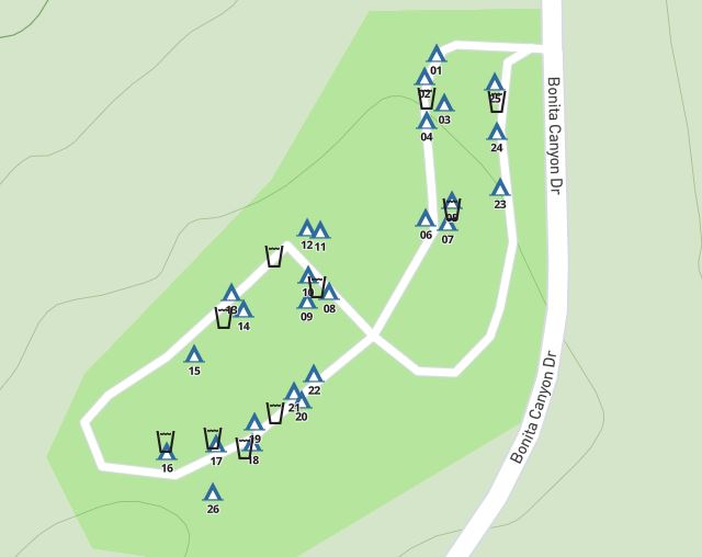
By walking down to the far end of the second loop in the Bonita Canyon Campground I was able to pick up a trail that goes back to the visitor center and also intersects the Silver Spur Meadow Trail which runs down the valley and joins up with the Bonita Creek Trail at the Faraway day-use area.

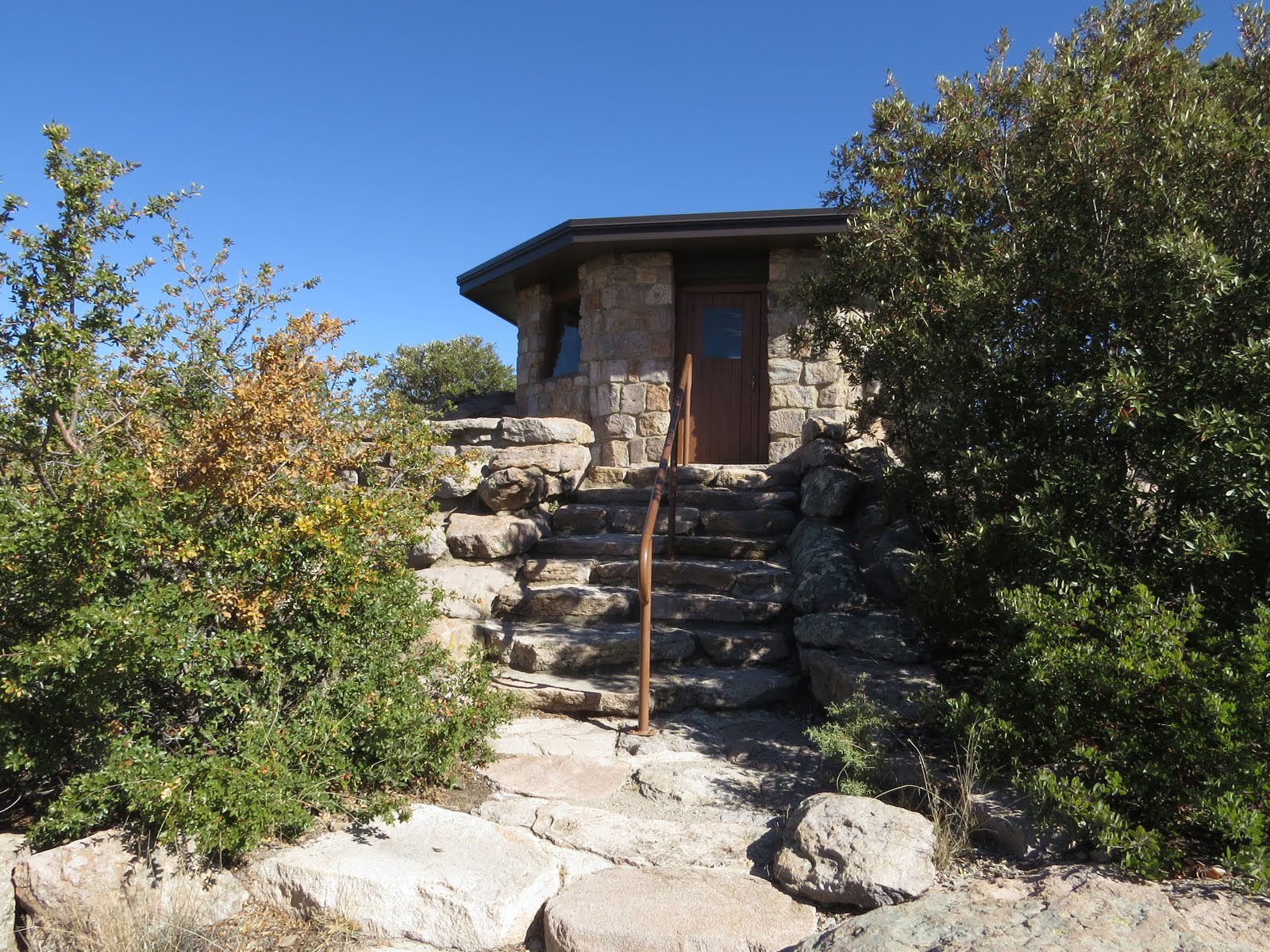
Note: The young seasonal ranger that was checking campsite tags, with her butt firmly planted in the official monument pickup's seat, had no idea where in the campground that trail could be found so I was on my own. Most rangers I've come across are pretty enthusiastic about their little bit of the world and know the trails well. Friendly as she was, I'm not sure how this young woman's park-service career is going to work out.


The definition of a desert, a place receiving 10 or less inches of rain per year, seems pretty straight forward, and, at 5 to 6 inches of rain per year at Wilcox, 32 crow-fly miles away, here at the lower elevations of Chiricauhua I am firmly inside that definition, (The upper elevations of the Chiricahuas wring more moisture out of the sky than that, which can be an issue at the campground during the monsoons because it has a wash running right through the middle and Bonita Creek along one side!) yet apparently the boundaries of specific deserts are more nebulous than you might expect.

One map shows the Chihuahua Desert, which includes Guadalupe Mountains National Park where I just was, firmly bleeding over into far southeast Arizona, where I'm at now, yet at the same time has the Great Basin Desert barely encompassing the western half of Utah,


while another map includes most all of Utah and a bit of Colorado in the Great Basin Desert, but places the Chihuahuan Desert's boundary well back into New Mexico. This sort of leaves me in a kind of nameless limbo somewhere between the Chihuahuan and the Sonoran deserts, so in that sense I'm not exactly sure where I am.

Regardless, unlike Guadalupe Mountains where the lower elevations are firmly in the desert and you climb up into the forests, here in Chiricahua this lower-elevation trail, the Silver Spur Meadow Trail,


starts out firmly in the woods and stays there,


except when it is passing through one of the several meadows along the way - hence, I'm assuming, the Meadow in the trail's name.


Though flanked closely by the canyon walls on either side, which do a great job of blocking the remainder of the wind that tore through me at Apache Pass a few hours ago, this is pretty much a flat trail and is suitable hiking for most everybody.


If hiked all the way down to the Erickson Cemetery near the entrance to the National Monument (That final 3 tenths of a mile is not official trail but enough people have walked it that you won't be breaking new ground. If all else fails take to the road for that last little bit.) and back to the campground or visitor center again it is only about 5 miles of gentle hiking all-told.


The trail is never far from Bonita Creek so I imagine that even if this were summer, it would still be a pleasant hike.

Yes, I did say summer and I am talking about the desert southwest, but it should be noted that the high here in the desert environs of Chiricauha reaches an average of 93 in June with average lows reaching down to 69 for a mean temp of 81 with humidities running about 20%. In Central Texas where I hunker-down and sweat out the summer the average high is 97 with lows of 75 for a mean temp of 86 with humidities running about 80%. Wana guess which one is more comfortable??

Anyway, the namesake of that first trail segment, Silver Spur Meadow, is an actual place. In 1934 this was a CCC camp for company 828.

There's no real trace left here of all those young men that lived in this camp, working hard for a dollar a day, most of which he never sees since $25 per month is sent directly back home to his family, but the results of their work, officially named project NM-2, here in the Ciricauhaus are still here in the trails and facilities of the National Monument.


By the late 40's any trace of the CCC camp was obliterated by a lodge and facilities for the Silver Spur Guest Ranch and the two massive chimneys located almost right in the trail are from that era.

Of course in those days there was a lodge wrapped around those chimneys and they weren't just standing there naked in the meadow. You can still see where the roof and walls met the chimney.


I also suspect that this remnant of an old clay waste-water pipe is from the lodge days, since I don't imagine those CCC boys had anything more in the way of bathroom amenities than out-house privies and a tarped-off shower area, probably off to the south side of the meadow, well away from the creek along the north side.


A little further down the trail, nestled alongside the remnants of an orchard painstakingly planted and cared for by hand


is the Stafford Cabin.


The original part of the cabin, a single room about 14x14, was built in a hurry as winter approached by Ja Hu and his child-wife Pauline (12 years old which sounds downright distasteful nowadays, but then the times were different back then)


with unpeeled logs, a dirt floor and split-shake roof.


They expanded the cabin several times, (Had to with 6 children!) first with a second log room tacked onto the first and spliced in with some vertical timbers, and then a series of lean-to's. The family ended up living here for some 20 years.

(I find that doing research on things like this before I go enhances the experience once I get there. There is some information on the info-boards along the trail, but the Chiricahua National Monument web site has more in depth information and I think it's worth-while spending some time going through all that while I still had internet access before leaving on this trip.)


Next stop down the trail is the far more elaborate Erickson Homestead


which Lillian Erickson (Riggs) named


Faraway Ranch "because it's so darn far away from anything."


Lillian, standing on the right with her brother, sister and seated parents, was born at the Fort Bowie hospital and was plagued with failing eyesight and hearing from a young age, yet she still managed to complete college and taught school around southeastern Arizona for some years. She did try moving to California for a bit (her sister lived there with her husband) but that didn't work out and she lived much of her life at Faraway. With husband Ed, they ran it first as a ranch/orchard then a boarding house and finally a guest-ranch.


For a guest-ranch the horse-barn seemed a bit small.


It's said that Lillian, though mostly deaf and completely blind by that point, ("I tried to learn braille but my work-hardened fingers were not sensitive enough.") would stand at the squeeze-chute and reach through the slats to feel the cow's ribs and determine if it was ready for market yet or not.


Starting in 1988, after ten years of cataloging the contents, guided tours of the Faraway Ranch house  are given by park rangers, (Otherwise it's off limits) but mostly on Saturdays and Sundays, and this wasn't either of those, which was too bad since I wouldn't have minded getting a closer look at this remarkable family. (Check the web site calendar for dates and times of the tours)


So I had to content myself with wandering on down to the cemetery, admiring the valley step by step and imagining living here instead.

Eventually I ran out of trail, if not daydreams, and headed back towards the campground.

Even without the guided tour, this was a very pleasant and informative hike.

As I hiked through this bucolic canyon it was easy to see why men have been drawn to this place since at least the 1400's.

During my hike I ran into a couple young-people (Of course from my perspective young covers a pretty broad spectrum!) wandering through the meadows between Faraway and the Stafford Cabin using sticks to thresh the tall grasses into a bucket.

This seemed curious behavior so as I passed by them a second time on my way back towards the campground I set my social reticence aside and asked one of them what the heck they were up to.

Turns out the ranch had been well managed in terms of protecting the natural ecology, and they were collecting native seeds for a restoration project somewhere that wasn't so lucky. These are tiny seeds and it took a hell of a lot of threshing to get just a small hand-full into the bottom of the bucket!


Monday, February 24, 2020

Camping in Chiricahua National Monument


After getting blown out of Apache Pass like a hapless tumbleweed that couldn't find a fence to latch onto, I headed on towards my next destination, the Bonita Canyon Campground in the Chiricahua National Monument.


With the campground being in a wooded canyon I had hopes that the wind would not be as much of an issue there, but I was taking a chance in trusting that I could drive up blind and nab one of the 100% reservable sites at this 24 site campground.

Last night I had gone onto reserve.gov while at the rest area and found that site 22 was available for the next two nights, but then discovered that somewhere along the way my account had gotten screwed up and the system wouldn't let me log in to actually reserve the site.

There is a get-out-of-jail-free-card button that will send a link via e-mail allowing you to reset your password so I clicked. . . And waited. . . And waited. . . And waited.

It took over two hours for the e-mail to be sent to me - and then when I attempted to reset my password with the provided link - several times - it told me there was an error and I would have to try again later.  A second 2 hour wait for a fresh link yielded the same results. . . and by now it was way past dark and getting too damn cold in The Van to stay up any longer, so I gave up and climbed under the covers for the rest of the night.


Oh well, If the Bonita Canyon Campground is full I can go around the corner to the adjacent Coronado National Forest where the MVUM (Motor Vehicle Usage Map) shows that dispersed camping is allowed (those little grey dots on either side of the road) along Pinery Canyon Road, also known as FR 42.

Generally speaking, the Forest Service road numbering convention is that two-number roads can be handled by most vehicles other than low-slung sporty jobs and those too big for the averagely skilled person to be driving anyway, three-number roads are OK for average sized high-clearance vehicles, and four-number roads are getting iffy and may be limited to 4X4's.

Of course this is highly dependent how long ago it rained (The fact that FR 42 is drawn as a double-line road means that only street-legal vehicles are allowed on it, not that it is paved, which it's not.) and how long it's been since a grader was run down the road. In the case of Pinery Canyon Road, I drove the first 8 or so miles of it a few days later and it was no problem as far as clearance and van-size goes, but it had the worst washboard I ran across on this entire trip, keeping my speed down below 10 MPH. And no, going faster, at least up to 45 MPH, after which I chickened out, did not smooth things out at all, in fact quite the contrary.


But for now I was trusting in blind luck that the Bonita Canyon Campground site would still be available by the time I got to the visitor center.

___

Followup on the reserve.gov account:

I never was able to reset my password while on this trip, nor create a fresh account since one with that email address already existed. I still have no idea what broke the account in the first place but turns out that the reset problem was Chrome. Something about Chrome broke the reset-password process, but once I got back home and had access to Explorer, and, incidentally, no longer needed to make a reservation,  the reset worked like it should.

I have no idea what tangled up the account in the first place but it let me "reset" my password right back to what it was originally, and then log in properly from the Chrome on my phone. I guess it's that dot-gov bit that screwed things up.

I am backed into this site about as far as I can get and as you can see, it is only a single vehicle wide. The pickup to the left is parked in site 20 in front of a 25' travel trailer, one of only a handful of sites large enough for this. 

Fortunately for me, the site I had my eye on was still available when I got there, but I could only take it for one night because the system will not let the visitor center go beyond that one night without a reservation but I couldn't make a reser - well - you get the idea. . .

In the morning I would have to go back to the visitor center again to see if I would be allowed stay another night. Beyond that I knew the site was definitely reserved. (I was able to stay the two nights.)

At $10 the cost was the highest I paid for a campsite on this trip. Would have been $20 without my geezer pass.


This is a typical National Park/National Forest campground in that the sites are small. In fact no rigs over 29 actual feet in length are allowed in the campground. This is in part because there is quite an abrupt dip through a wash where the two loops meet and judging by the drag marks in the pavement at the low points, even shorter rigs bottom out in here.


But also because the site sizes are limited. So when making a reservation check the site description, especially the Driveway Length, carefully.

The one above is for site 20 which , at 41 feet long, is long enough for a modest motorhome/toad or travel trailer/tow vehicle combo.


But this is the description for site 22, my site, and you can see that it is only 20 feet long, with a stove-sized bolder blocking any further progress, so don't try to get in here with any sort of motorhome other than a van-conversion and forget the trailer/tow vehicle!

I have no idea what it means when it says that Equipment is Mandatory, but this was noted on every site I checked.

And notice that Driveway Grade: Slight?  That's what it said for every site, but some were more slight than others. I did do a walk through and decided that I could use any site in there without bothering with leveling blocks, but then again I have more tolerance for being off-level than many, especially those with absorption fridges and balance issues.

There is a bathroom with flush toilets right there where the figure-8 of the campground road crosses itself, though no showers.

No hookups either, nor a dump-station, but plentiful water spigots for filling jugs. And if you are tent-camping, each site has a steel food-vault on it because - well - it really sucks when a bear shreds your tent to get at the cheese-puffs!


For those with small to modest rigs that are set up for a few days of dry-camping this campground, tucked here in the wooded bottom of the canyon, might just be the ticket to a pleasant little interlude somewhat off the beaten path.

Of course the Bonita Canyon Campground has one other key attribute.

Access to the Chiricahua National Monument trails!

The geology here, being volcanic in nature, is quite different than at Guadalupe Mountains and since it's still early enough in the day, and the clouds have cleared up nicely, and the wind isn't at all bad down here in the canyon, I'm off for a hike to take a closer look.