Monday, October 30, 2017

Keeping Terre Haute Slightly Weird


Terre Haute has a city slogan all its own, but I couldn’t help but think of the Austin Texas publicity slogan Keep Austin Weird as I killed off the last of the daylight in this little city on the Wabash River.


I had begun making my way back towards Texas after the third of three trips in three months up to Michigan and back. (All this traveling was for a variety of reasons, 1/3rd planned and 2/3rds unplanned.) At 1300 miles one way that’s a whole lot of miles and the last two trips were only two weeks apart so I was pretty beat up and just loafing along on what I hope will be the first segment of the of the last leg of the last Michigan trip for the year.


I had just made the very pretty drive down Indiana Highway 47 out of Crawfordsville, cutting right through the southern part of Turkey Run State Park just before picking up US-47 South for the final run down to Terre Haute.


I was off on this seemingly less than direct route because I’m not a fan of going through Indianapolis and over the years have developed several alternative routes that take me around that congested part of the state, and to be honest I can’t see where my alternates are all that much slower than fighting my way through the snarl of I-465 and then across that long boring run of I-69 to Fort Wayne. (or I-70 to Terre Haute if I'm going the other way)

Currently the alternative route I was on today is my favorite. (But after a few more trips I’ll probably get bored and switch to another.)


But! If anyone knows of an elegant way to get from/to SR-25 in the northeast to/from US-231 in the southwest (the two red circles) of the Lafayette/West Lafayette complex let me know.  Right now the red route seems to be the best at avoiding stoplights and narrow city streets, though it’s not perfect, but it’s better than the variety of green routes I’ve tried out over the years.

For some reason these two cities seem to have a schism between them that has left a legacy of no straightforward connection from one side to the other.


 At Terre Haute I usually pick up US-40 at the northeast corner of the county courthouse and jump across the Wabash River, picking up I-70 right there at the state line, (Going through Toad Hop along the way. It’s only a half-dozen hap-hazard streets, but how can you not notice a place called Toad Hop!) but it was still two hours till sunset, and the rest area I had my eye on for the night was only a few miles away.


Arriving at the night’s destination before the cool-down that starts in earnest just after sunset means sitting around in the heat, so I checked my map and saw a green patch right on the Wabash River just south of where I usually turn west. Green patches in the city mean parks, and sure enough this green patch was called Fairbanks Park.

City parks can be a mixed bag, everything from an abandoned lot to a great little oasis. Being right on the banks of the Wabash River I figured chances were that this was one of the latter, or at least leaning towards that end of the park-nicity scale, and I was right!

But before I knew that I took my chances and I passed up the courthouse by a few blocks, driving into Indiana State University territory, and hung a right on Farrington which ran two blocks straight on into the park.

At first, based on the number of cars parked just inside the entrance, it looked like it might be a pretty crowed place, but apparently the occupants of that first batch of cars were taking advantage of the Y, which sits there just inside the entrance, to get in a post-work Monday evening workout. The rest of the park wasn’t empty, but it was only lightly occupied.


But enough of all this setup crap, on to the weirdness.

Just past the Y I found a mostly empty parking lot, picked out a spot with no overhanging branches to sweep the AC unit off the roof, then wandered down towards the boat dock/launch area.

I had just barely gotten there when Jim (For privacy sake, not his real name, at least I don’t think it is, but since I can’t remember his real name I may have managed to randomly pick it anyway!) walked up and started a conversation. Social interaction is not exactly what I was looking for, but it is what it is.

Jim is retired now and living on his own in the multi-bedroom house where he raised his kids just a few minutes away. But Jim’s two children have scattered in different directions and the weird thing is I, a random stranger he walked up to one day, have close, or at least some, association with both!

His son lives in Houston not far from where The Wife and I did and I know the neighborhood, including MD Anderson where he works, well since The Wife and I walked our dog in the area countless times when we lived in the Montrose district. 

And his daughter lives in Findlay Ohio where she works for Marathon Oil.

So what’s my connection with her?


Well, a few years before she started working at the then world headquarters of Marathon Oil in Findlay, I was wading through thigh-deep water in the shadow of her current office trying to salvage computer equipment my company had contracted to Marathon Oil. (The Blanchard River seems to spring it's banks ever 10 years or so, even today.)

And, she often visits the now world headquarters of Marathon Oil in Houston, which is in a 32+ story building that I helped wire for data during it’s construction. (Holy Crap but that was a lot of stair climbing since the elevators were not yet working and the construction elevator had to be scheduled in advance. . .!)

While Jim and I are standing there and I’m pondering the preponderance of connections between the two of us (Oh yeah, Jim makes regular trips down to Houston to help two very busy parents with their kids and is quite familiar with many of the place along the way that I am.) I become aware of a faint buzzing out on the river that is getting louder.


I didn’t know this, and I still haven't figured out how it came to be, but apparently Terre Haute is a hotbed of hover-craft manufacturing and the skittish craft are often tested right here on the river. In fact here comes one now, sweeping across the river and right up the long, steep launch ramp. At slow speed hover-craft are directionally challenged and Jim and I had to step lively to keep from getting run over! (To launch on the steep ramp they back down, increasing the throttle to slow and reducing throttle to go faster, because, well, the brakes suck!)

This particular craft, (Not the one pictured above because I didn't have my camera with me.) a 4 seater with the rear seats set higher than the front so all could see, was lettered POLIS which I happen to know is 'police' in Swedish. And no, there’s no exciting story behind me knowing that, it’s just that The Wife and I enjoy watching the Swedish police drama Wallander. (With subtitles of course!)


But wait!

There’s more weirdness to come!

After the excitement at the boat-launch Jim headed back to the house and I started wandering the park, which is actually not bad, with playgrounds, pavilions, fountains,


and an outdoor amphitheater/stage, but it wasn’t until I was down near the dog-park that things got a little wonky again.

While approaching the fenced in dog-park, with its two separate ‘corrals’ in case your dog is not social, (Oh hey! Maybe I need one of those?) I see a young man (college age) walking a cat along the winding sidewalk ahead of me.

“Oh cool!” I thought. “He’s trained his cat to a leash. . . No, wait! There’s no leash. That cat is just following along, playing in the edge of the bushes, then running to catch up and hop around his feet before diving after a random loose leaf blowing by. Even Cooler!”

Except that when the guy turns around and walks back towards me the cat just lays down in the grass and watches him go. Turns out the cat is not his at all, just some feline that popped out of the bushes and tagged along for a while.

Of course, since cats hate me, when I walked by the cat never moved anything more than his head as he watched me suspiciously while I passed.

Between Jim, the hover-craft, the playful cat that hates me, and the very friendly middle-aged guy that was either extremely eager to help if I needed anything, anything at all, or was cruising me, (Very flattering if it was the latter, but sheesh, he either needs a new prescription or is scraping the bottom of the barrel!) by the time I wandered up to the north end of the park and back the sun was below the horizon and it was time to head for the rest area for the night.

The Illinois rest area on westbound I-70 at mile marker 149, just west of the Indiana border, is one of the better ones for overnighting in a van or other vehicle that fits on the 'car' side. It not only has the truck parking located between the freeway and the car parking which makes the car parking a little quieter, but the car parking also has this unusual S curve shape which means that I can curl around and park The Van such that the building is between me and the trucks, making it even quieter.


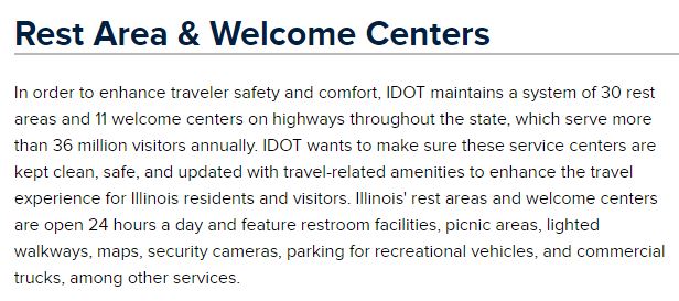
But despite the friendly lead paragraph on the Illinois DOT web site, you can’t trust rest areas in this state. Some chowder-head in this cash-beleaguered state believes that a good way to save money is to ‘temporarily close’ rest areas ‘for upgrading’, although when I drive by I never see any construction going on, just the old, battered pickup of the care-taker who’s trying to keep the facilities from melting back into the earth from non-use.


At any given time it seems like 20% to 30% of the 30 official rest areas in the state are closed.

Right now if you want to travel from Terre Haute to Effingham then down to Cairo you are shit-out-of-luck (Pun intended) for 200 miles because the first 3 of the 4 rest areas along that route are closed.

Personally I would think that a state in such need of dollars wouldn’t want to piss off tourists bringing in those dollars or truckers carrying the commerce that ultimately creates the tax-base, but what do I know, I’m not a politician.

At any rate, on my way up this trip I looked over and saw that my chosen rest area was open and if that had changed in the few days since there are some truckstops just a few miles down the road where I could make do.

As it was, when I rolled up that evening the barrels were lined up along the shoulder but the rest area was open, though when I woke up in the morning the building was locked up and a brisk walk to get the blood flowing before hitting the road revealed that sometime in the night the barrels had been moved into blocking position.

I guess all that weirdness in Terre Haute threw a little good karma my way, letting me slip into this rest area just ahead of the shutdown!


But now it's time to get rolling on down to the Shawnee National Forest in southern Illinois because they promise some hiking down there and a guy can't sit behind the wheel all the time!


Thursday, October 26, 2017

Note to Self: Saddle Lake is Not a Horse Camp!


I don’t know where I got it into my head that Hoosier National Forest’s Saddle Lake was a horse camp, but it’s not!

Maybe my simple mind got confused by the name of the place, who knows.


Anyway, horse camp or not, there's a 13 site easy-for-any-car-to-drive-into campground with vault toilet in here. I saw one reviewer say that a sign was posted indicating that in 2017 there would be a $5 fee. I could find no such sign and the sites are still free at this point.


But don’t expect to harvest much solar in here among the trees.


And water??

Maybe at one time, but not now.


What Saddle Lake does have, besides being within 15 miles of I64 for when I finally start my two-day marathon drive towards the storm-battered homestead in the morning,


is a 2.6 mile (According to my GPS track regardless of what the sign says.) trail circling the lake.


Doesn't mater which direction you hike, clockwise or counter, the trail starts and ends near a small boat-ramp. (Small lake, small ramp)


This is one of four flood-control lakes built along the watershed of the Middle Fork of the Anderson River.

Apparently at one time Saddle Lake was once a full-blown recreation area, but in this case, build it and they will come, just didn’t work out, so the place has been scaled back to a primitive site that doesn’t seem to see much use.


But primitive or not, it is a pretty little trail quietly sandwiched between the lake on one side and rolling deciduous  hills on the other.


This time of year (End of August) it was a buggy place though, (The trail that is, the campground, up on higher ground, seemed fine.) mostly chiggers with a few ticks thrown in, and my old standby of straight vinegar liberally applied out of a spray-bottle just wasn’t doing the job, so my seldom-used  DEET-based bug-juice was definitely needed. (Ask me how I know this; go ahead, ask!!)


Checkers anyone?

Maybe a game of forest-chess for the more cerebral among us?

At any rate, this strategy for speeding the decay of stumps has given me an idea for a shop-project using some of the larger trees that I've had to take down on the property. . .


For the most part the trail was easy to follow despite the light usage


Right now it’s kind of hard to imagine tiny little Thies Creek causing any flooding


and here I’m standing in the spillway, the really wide and high spillway, struggling to visualize the water coming up this high, but given all the flooding at home right now due to hurricane Harvey maybe I’m just in denial because the people that do these things don’t build dams just for the hell of it!


OK, between roosting buzzards and chiggers, enough hiking for the day, time to head back to camp and chill before getting a good night’s sleep because Harvey, nearly stationary for the past several days, is finally starting to slowly drift to the east and come morning I'm going to start the first of two long days on the road as I slip home behind the soggy bastard!


Monday, October 23, 2017

Sports Car Roads and Buzzard Roost


Nope, this isn't a weekday but rather a Sunday morning during prime camping season a week before Labor Day

Ahhh. Another dawn here at Blackwell Horse Camp, just waiting on the sun to appear over those trees.

It’s going to be another gorgeous day (Did I mention that I have enough bars here to pull up the WeatherBug app??) and there’s plenty of interesting looking trails nearby, in fact I’ve kind of got my eye on that Sycamore Trail just down the road.

But I just can’t do it.

I can’t sit here another day. (Notice that I already packed the tent the night before.)

Hurricane Harvey has been holding me hostage for three days now and isn’t done with me yet, but I need to do something to give myself the illusion of moving closer to home.


As far as trails go, Buzzard Roost doesn’t look like much on paper, though at 0.8 miles, the trail map shows it as being a full 3 tenths longer than shown here on the Hoosier National Forest Trails Guide, (All published by the same entity, but since it’s the USDA the fact that they can’t quite sync things up isn’t surprising.) but the story behind the name of this site right on the Ohio River drew me in anyway.

(My actual out and back GPS track was 1.24 miles so it seems neither number is correct. . .)


In the late 1800’s the Hatfield family (That’s Job Hatfield and I don’t know if they are related.) operated a smokehouse in Magnet, a couple miles further south along the river. They did all their own butchering and as you can imagine this produced scraps; well, scraps to them, gourmet to buzzards.

When full the buzzards would roost on the bluffs above a bend in the river about halfway between Magnet and the larger town of Alton. (I guess not many people wanted to live too close to a smokehouse operation so Alton got the people!)

To get from where I was to where I wanted to go, I took SR 37 south out of Bedford. In the pre-interstate days Indiana 37 used to be the highway, running from the southwest corner to the northeast corner of the state, with 110 miles of that being 4 lane-divided. Now the whole stretch from just south of Indianapolis to just north of Fort Wayne doesn’t exist anymore, buried beneath urban sprawl and I69. And it won’t be long before the segment from Martinsville down to Bloomington will also disappear under a new chunk of I69 that is already under construction.

Today my drive from Bedford down to Paoli is interesting, but not terribly spectacular or noteworthy. From Paoli south that changes though. Somewhere in the process of working its way through the streets of Paoli the flatish farmland is left behind and, while some farms do still exist, SR 37 is now snaking its way through the ridges and hollows of the Tell City Ranger District of Hoosier National Forest.

And snaking is the operative word here!

If the posted speed limit along here is 55 that means that there are going to be a whole mess of 45 MPH turns and curves to be negotiated, if the speed limit is 45 then the turns and curves  are down to 35. In either case, driving something as heavy and tall as The Van there’s just not enough time and distance between curves to get it up to the speed limit, (Especially with my light foot more suited to a grandmother than a ball-carrying member of the male subset. . .) though for sports car enthusiasts this must be a dream drive!

Twisting and turning, climbing and dipping, through the woods of southern Indiana with the windows, and maybe even the top down, with occasional roadside beverage stops along the way to keep everything lubed and cooled. Almost makes we wish I had one of those little Italian jobs to drive, but my luck, it would turn out to be a 30 year old, 30 MPH Vespa scooter. . .

At English (given the Amish population in the area perhaps this town was named for its preponderance of non-Amish inhabitants?) I leave 37 and switch over to SR 237, which, if anything, was even more twisty and turny and sports-car worthy (As long as you can get around that slow-ass van up there in front of you!!)

Eventually I come to my turn onto Onida Rd., which isn't all that well marked so it was a good thing I was keeping track of the mileage from that weird three-way intersection in Sulphur where SR 66 confuses the crap out of things by nearly doubling back on itself to head east one way and south the other. . .

When you’re in the woods you take every opportunity you can to suck up that solar!!

From what I had read about the popularity of Buzzard Roost as a picnic and family gathering spot nowadays I envisioned a fairly developed recreation area with picnic shelters, brick bathroom building and paved walkways.

Instead I find an overgrown wide spot in the single-lane access road that doubles for trailhead parking. But first, not recognizing it for what it is, I bypass that, thinking it must be an overflow area, and drive on into a tiny little 5 site campground with no water and a single construction style, plastic  portapotty perched at a cockeyed angle beside the loop at the end of the road.

Being a Sunday I'm also prepared to deal with crowds, but it's just me and the couple occupying the only camp in the campground.


As for the trail itself?  Well it clearly hasn’t seen a whole lot of traffic this season, but I don’t let that stop me.


Not too far in from the trailhead is an observation deck perched up there on the bluff with a couple bench seats nearby (Behind me) for those that find the couple-hundred foot stroll from the parking area taxing.  (OK. Yes. I used the benches, but only on my way back up from the river!)


The view is across the river to Willett's Bottom in Kentucky and I hang around a while to see if there is anything going on. (There isn’t, not even any traffic on the river.)


But the trail continues on, squeaking through between the campsites (See the tent of the only camp there to the right?) and the bad part of the bluff. You know, where gravity switches from keeping your feet planted on the ground to making you temporarily fly as you head towards the river below.


Past the campground, trees to the left of the trail try to give the illusion of security, but I still know the edge of the bluff is right there, just a couple steps away.


And there are a few points where the trail sort of tips over the edge, such as here where I’m pointing the camera pretty much straight down.

But as long as you can handle two stairs at a time, with one or two butt-slides or all-fours scrambles thrown in for good measure,


you’ll be able to make it all the way down the bluff to this rather grown-in bench on the banks of the river,


or, if you bypass that then a few steps later you can stand at the water’s edge and look up-river where Alton is hiding around the bend,


or downriver towards Magnet.


In fact, with enough zoom you can see some of the rental cabins, a canoe livery and river-side parks that make up Magnet today.

The main road, a county road called Dexter Magnet, crosses there between the buildings and the river and I’ll be going through there later when I leave here.

Assuming I can make it back up the bluff to The Van. . .


Thursday, October 19, 2017

Hickory Ridge Tower; A Questionable Climb


Just a few miles further up the ridgetop hugging Tower Ridge Rd from the Blackwell Horse Camp sits the 110 foot tall Hickory Ridge Lookout Tower.


This particular fire-watch tower was built in 1936 for a cost of about $1000 and by 1953 was one of 8 in the area and about 5000 nearly identical towers across the nation, though by 1964 it cost just shy of $10,000 to build one.


For several days I had been contemplating riding the Quad-B the 5.5 miles up the road to check it out. 

There's a trail of about the same length paralleling the road from the horse-camp to the tower but, while biking is allowed I would need a permit, and frankly an 11 mile hike (No permit required for hiking) there and back to see the tower just wasn’t – well, I just wasn’t feeling it!

To avoid the need for a permit all I had to do was ride the Quad-B to the the campground entrance, hang a left on Tower Ridge, and start pedaling, but on my way back from hiking Whitetail, since I was already in The Van, I decided to bypass the campground and just drive on up to the tower instead. (Nice how well that worked out isn’t it!)


There was virtually no traffic on the narrow gravel road but it was a little after noon on a Saturday and the area is criss-crossed by trails. Along the way I passed the Grubb Ridge Trailhead which looked to be pretty well packed with cars.

In fact the base of the Hickory Ridge Tower is also a trailhead for several trails, not to mention a relatively short hike down to an old cemetery, so the tiny parking area there was pretty crowded as well, but I managed to find a spot to slip The Svelte Little Van into, though all the sunny spots were already taken so I had to settle for shade. (When you live on solar you pay attention to things like that.)


Most of the occupants of the cars must have been out on the trails, but I had just finished a hike and had come here for the tower experience.

Considering our nanny-state's liability concerns as well as budget constraints, I thought I would be coming to look at the tower from the wrong side of fences and locks so wasn’t expecting that last little line on the lower right of the sign.

Now to the sensible that reads as a warning, but – well – yeah, you know where this is going. . .


9 landings, 133 steps, and 110 feet up to a little box just barely large enough to lay down in!

How could I say no?!


Weellll. . . Partway way up that question changed to what the hell was I thinking!!

The steps were no big deal, I’ve climbed worse, you just take them slow and steady, but remember that $1000 price-tag to build this thing? Well I’m here to tell you, it was so damn cheap because this thing is SpindlY; with a capital S capital Y!!

I had covered about 2/3rds of the climb and was doing fine, but then I did something wrong which set up a harmonic wobble in the entire tower that was suddenly attempting to throw me off! I had to stop where I was and hang on tight until it finally died down.

OK, that’s enough to make a guy reevaluate the decision that put him up here in the first place!

It didn’t help that now I was reminded of reading that long-time tower watchman Raymond Axsom was pretty scared the time the tower got struck by lightning, but the time he was really scared was when a sudden storm blew in and the tower was whipping around so bad all he could do was wrap his arms and legs around the steps he had been caught out on and hang on.

But, then again, I already had all those steps behind me and when I, very slowly, tilted my head back until I was looking straight up I could see that there were only three more landings to go!


Back in the day there were no yellow railings here in the tower,

Stolen photo. The alidade in the Hickory Ridge Tower has long since been removed.

just a hinged trap door that didn’t interfere with the alidade used to vector in on fires.

I don't mind the railings!


In the early days of this tower there were some 80 farms and homesteads around it, but the vast majority of those have been reclaimed by the forest now


along with several small communities such as Yellowstone, Maumee, and Elkinsville.


My stay in the tower was cut short by a quad of young people crowding in behind me about 15 minutes after I got up there.

Two young couples, one of the most dangerous demographics, what with the males egging each other on as they try to impress the females, who, at this age (Mid 20's) still love the attention and are encouraging the boys with giggling glee.

I bailed out, OK, more like carefully eased on out, and left them to their post, but only just, adolescent mating rituals.

Once I got my feet back on solid ground I went in search of any signs of the garage, which wasn’t hard to find since the foundation had been solidly built,


and the house that used to go along with the tower.

Both can be seen in the 1951 photo on the bottom left of the sign now at the base of the tower. (Visible in the fourth image from the top of this entry.) The house is easy to see in the photo and the garage, or work/storage shed, is just peeking through the trees there across from the house.

Once I found the foundations, which in the case of the house was more like a full basement, I was already at the beginning of the 5 mile Sycamore Trail, (Hike only) with it's one-mile side trip to Terrill Ridge, the high point in the wilderness.

Hummm, another ambitious hike today, or head back to camp and catch up on my magazines while sitting in the shade with ice-cold water and some crackers & hummus ???

Oh hell! I’ll just save Sycamore Trail for next time. . .