I'm a map person.
Always have been.
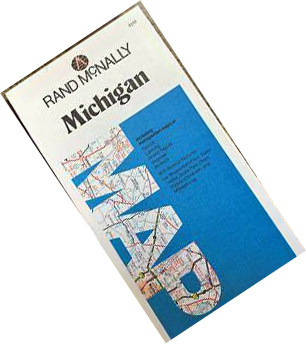
I like maps!
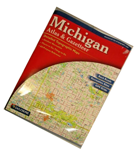
as well as the more detailed book-form atlases.
They were in the car, on the kitchen table, under my bed, and even illicitly tucked into my schoolbooks. (With the right textbook, if you hold it up at an angle you can hide more interesting reading material from the teacher!)
So I've spent many hours with maps. Sometimes finding my way - and not in the zen way - although that probably couldn't hurt.

Sometimes orienteering, which is something we did a lot in my Scout Troop.
But I'm also a mild teckie, (As opposed to a rabid teckie. The difference is that I still turn my lights on and off with a $3 wall-switch and not with an app on my cellphone and $100 dollars of added gear.)
so many years ago, long before Google Maps came about, I added electronic maps to my repertoire.
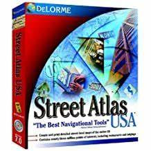
I started out using the Delorme Street Atlas for PC, and after several versions of that (The only way to get updates on Delorme's products was to buy the new version every few years, but fortunately it was surprisingly affordable,) I eventually switched
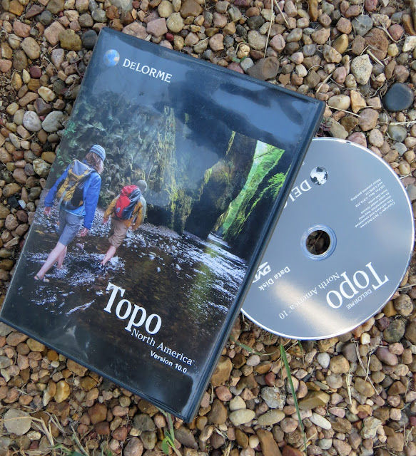
to the Delorme Topo series.
All the useful features of Street Atlas, though still the same sort of update strategy, but also the topo feature that the hiker and off-the-beaten-pather in me could put to good use.
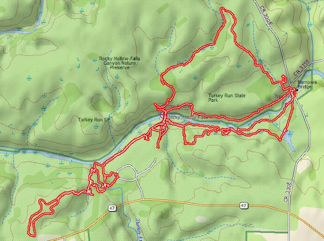
In addition to uploading the GPS tracks (recorded on a Delorme Earthmate PN-60 handheld) from my hikes into Delorme Topo
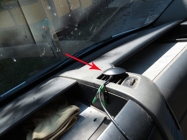
I also use this USB GPS puck for road navigation right on the PC
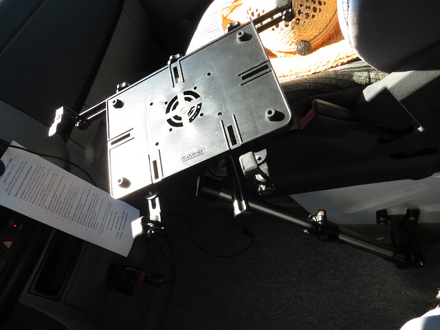
using this stand clamped between the seats, on which
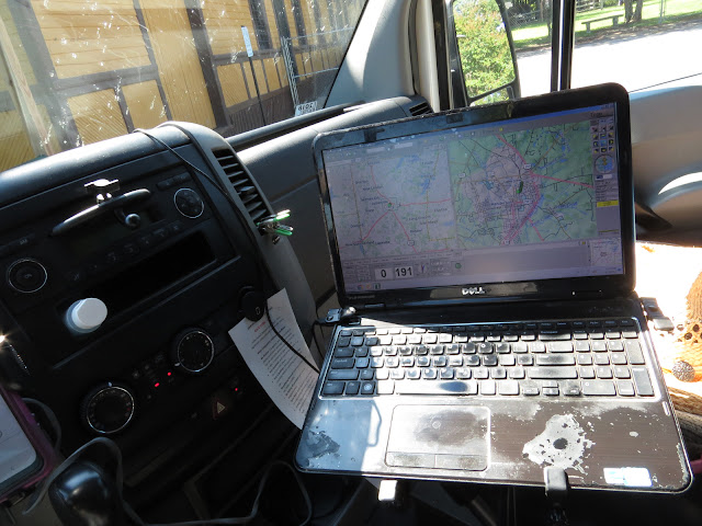
I've been setting my PC up next to the driver's seat for many years now.
If I stick to one of my usual routes I don't really need the navigation help, but even then, somehow being able to glance over and verify my position in the world on the longer trips is comforting. (More of that Zen stuff I suppose.)

And when I've wandered off onto a new route, something I'm prone to do, the split screen of the navigation mode, the right side a closeup view for picking out turns, (I can zoom in several times closer than this if necessary.) and the left side a longer range view that allows me to figure out where I am in the larger context of the world.

But - - - (Oh come on, with that title you knew there was a but coming!) - - - Garmin bought out Delorme's electronic division about 8 years ago and quickly scrapped the whole line of electronic products, all the GPS's and the whole line of digital maps - even though they had no comparable PC-based product of their own - to get rid of the competition.
So I've been stuck with my old copy of Topo 10 ever since.
There's been a whole lot of road construction since then and because updates aren't available anymore, I often find myself driving on what my outdated map thinks is empty land on roads that aren't supposed to be there. (i.e. Grand Parkway 99 around Houston, I-69 through southern Indiana, the Hooser Heartland Highway between Lafayette and Logansport in northern Indiana, US24 across northern Ohio)
Obviously this isn't going to get any better. And there's also the very real possibility that my laptop is going to crap out one day and force me onto an OS version that won't support my discontinued Delorme Topo. (I'm still running Windows 7 right now)
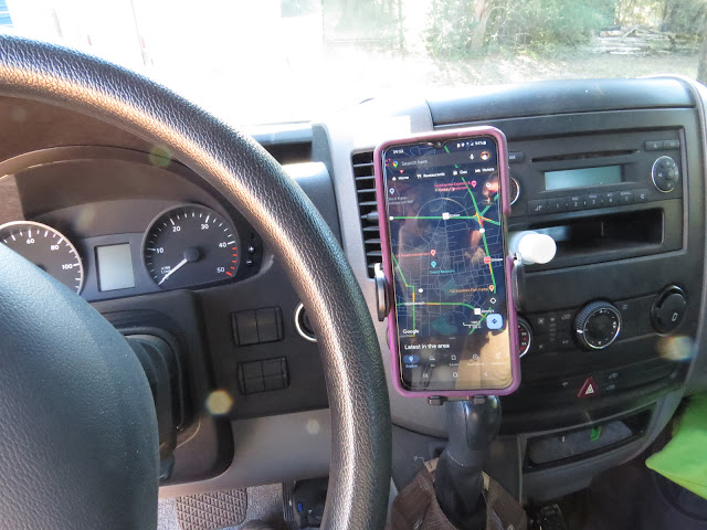
So for this year's family reunion trip I thought I might try weaning myself off my old standby, stop suckling at the teat of Delorme, and see what it's like to sit at the big-kid table with Google Maps instead.
- The split screen let's me do turn by turn navigation in one screen while keeping track of the bigger picture in the other
- I can leave breadcrumbs along my track which makes keeping tabs of where I am and the recent turns I've made easy (Sometimes that little blue dot on Google Maps is hard to locate with half-second glances)
- I can automatically double the width of roads and the font-size of place-names, and highway designations in navigation mode
- I can upload my hiking GPS tracks so I can refresh my memory when going back to a previously hiked area or writing a post about a particular hike
- The whole PC setup is bulky and intrusive
- The map is not update-able with new roads
- The old screen is fading with age making the map difficult to see under some lighting conditions
- The USB port the GPS plugs into is old and worn and sometimes drops connection, which means I do without until next time I stop and can slap things back to life
- Very compact compared to the laptop
- Roads are updated frequently
- Real-time (almost) traffic conditions
- Displays estimated arrival time making it easier to plan my day or give The Wife a heads-up on when I'll be rolling in the driveway (She hates for me to arrive unannounced!)
- Can easily switch on the fly to a weather app to check on conditions out ahead of me
- In "directions" mode, even with the volume turned off to shut the lady up, (Just because she's there doesn't mean I have to listen to her all the time.) it displays how far to the next turn and which way I'll be turning.
- Can't double the font-size or displayed width of roads making information and lesser roads difficult to see at a glance.
- Must "pinch" to zoom the screen out for a wider perspective then tap the "re-center" button to get auto-tracking (keeping my current location in the middle of the screen as I move along) working again, which also automatically zooms the screen back in whether that's what I want or not.
- All roads, regardless of type, are displayed with the same grey line
- No topo information


though the laptop with TOPO 10 will still be coming along because it still does some things better.

Some of them are places I've found and/or been to that I want to remember

Others are places other people have wrote or told me about that I might want to go to one day.


Thank god you're not knitting ticks!
ReplyDeleteAs far as you know anyway!
DeleteI just watched a show where very tiny micro-crocheted koalas played a part in a murder mystery.
Hmm, knowing how easily influenced you are, should we be on the alert?
DeleteYou're long overdue for a site on etsy. I won't begin to speculate on what you might offer, but given your talent with drawing and painting we're already on pins and needles.
Again i am laughing, i love your writing. And what comes to mind, I recently drove a highway ( the duffy lake road) and the speed limit signs said 100km, which to us, who also like to go slow, was impossible even going fast we could barely manage half of that on it's steep hairpin corners every kilometer. I also love maps a lot. like you still do and always did.
ReplyDeleteWe all end up in the same place in the end but we sure do seem to be in a big hurry to get there! I always shake my head at the person that has to pass me up-hill against a double-yellow line, just so he/she can sit in front of me at the next stop instead of behind me.
DeleteMy glovebox is filled with maps that I haven't used in years. I was slow to get on the smart phone train. It took years to make the transition from desktop to laptop to tablet to phone. My little phone can do almost all of the tasks that my desktop did and fits in my pocket or on the dash-holder (for google maps).
ReplyDeleteConsidering how much we rely on the little buggers it's hard to believe that the first crude smartphone came out only 25 years ago.
Delete