OK, truth is, The Falls here at Pedernales Falls State Park are probably not what you picture in your head as a waterfall.

If there is an underlying theme here in the Texas Hill Country it's limestone. (Yep, that 'underhanded' pun was intended.) Layers and layers of limestone laid down over unimaginable years. And here in this area tectonic activity has tilted those layers.
West is to the left in the photo above and that's also the direction from which the water flows in the Pedernales River, left to right, right into the barrier of the tilted layers.

At the northern tip of the State Park the water runs into a few particularly large slabs tilted up like this where it pools up behind them until it can spill over and run down the backside of the slopes.
This is what, perhaps slightly erroneously, is called The Falls. But true falls or not, this is a very popular part of the park which makes this early Monday morning, when the park is closed to all except the campers on the 20 or so available campsites, a perfect time to head on down that way.

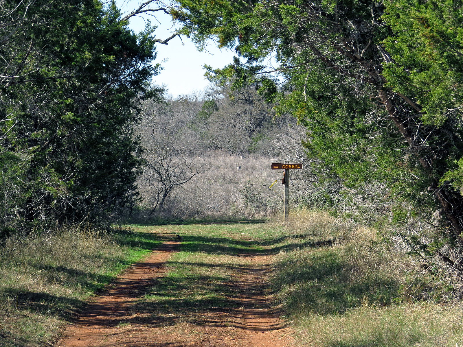
But first: The Falls are nearly 2 miles from my campsite, if I want to drive The Van down there, which I don't. Instead there is a whole trail network I can use to hike on down there. Much more pleasant than driving a paved road. But if I'm going to stick strictly to established trails that means I first have to walk the road the best part of a mile to reach the Bird Blind, which is also where the coral is, where I can then get onto the trail system.
For years my go-to solution for this has been to bushwhack up-hill due west from the end of the campground road for a quarter-mile until I intersect the South Loop Equestrian Trail. From this point I have access to the park's entire trail-system without having to walk any significant distance along roads, or drive The Van to a trailhead.

Between when I was here two years ago and today (Jan 25 2021) there was a fire across the area where I do this particular bushwhack, which actually makes the bushwacking a whole lot easier. More of a walk really instead of weaving my way through thick, and sometimes prickly vegetation.

But just because the whacking is easy that doesn't mean I get complacent.
Where my bushwacking intersects the established trail I take the time to build a marker so I know the right spot to leave the trail on my way back later on.
Many people build cairns for this because they are easy to spot. But because they are so obvious I prefer to just lay out a few stones on the ground near some recognizable feature (There is a decent sized cedar growing near the trail just outside this image to the left) as a pointer. Still effective if you are looking for it, but natural enough that it doesn't jump out and scream at you. In this case the two larger stones were already there, I just added the two smaller stones, although one would have been enough. Not that it really matters since, as always, I took the marker apart when I passed it on my way back.

Once on the equestrian trail system I have free-range of most of the park and work my leisurely way towards the north end.

I don't know. This looks pretty Jurassic to me.
OK, maybe Jurassic is a bit of an exaggeration, How-bout pre-historic instead?

But eventually I make it down to the river.
But man! That water is pretty high!
From here, near the western boundary of the park, I need to follow the river east for a while in order to get to the actual falls area. Usually I can just walk along the exposed limestone of the riverbed, but most of that is underwater right now,

so instead I'm forced up into the rugged terrain between the bluffs and the river. (Yep, there is a trail of sorts there right up the middle of the image.)

The up-side is that puts me up close and personal with the bluff where I can experience first hand the thick layers of rock (Left and top in the image) laid down over looong periods of time contrasting with the thin layers laid down and stacked up during successive short periods of the area being sea-bottom.

Some of these thinner layers are barely the width of a finger but still took thousands of years to lay down.

But all of them, thick layers and thin, after being cooked by the compression of successive layers then finally brought back into the daylight by up-thrusts and erosion, now show the wear and tear of flowing water.
Even those 30 feet above the current water level.

We humans seem to have this ingrained need to pick out the high spots and to leave visible calling cards that scream out "HERE I AM!". (Hence the popularity in this area of fancy but largely function-less entrance gates when the house is too far back from the road to be seen)
This place, one that was new since last time I was here, was perched way out there in the distance on the north, non-park side of the river, as high up on a ridge as it could get. In fact it was so far away that I didn't notice the scaffolding, nor the swarm of workers crawling all over this monstrosity, (We only take up a few square feet and can only be in one place at a time so why the need for so damn much "living" space?) until I got the image back to camp and onto my laptop.
A disappointing reminder that, in the name of vanity and greed, we are going to invade and sublimate our natural surroundings until we inundate ourselves into extinction.
But that won't happen today, so onward!

OK. Maybe not - - -
I'm almost to the falls area and normally I'd go around this down by the river, but that's all underwater right now so - - -
Look out! Old Man Climbing!


No comments:
Post a Comment