Monday, July 13, 2020

Dancing with Ghosts at Fort Lancaster


November 23 2019


The Texas Historical Commission manages - well, I don't actually know how many historical sites they manage, but it takes a 170 page brochure just to list all of them with a brief description for each.

That brochure, which is free, also comes with the map shown above.


On the first day of this current trip, my trip to Guadalupe Mountains and westward, nearly 3 weeks ago now, I was making miles on I-10, you know, because this is a big state and I had a long ways to go, when I passed a small sign saying one of those historical sites was coming up, but only if I was willing to get off the big highway and take the scenic loop that originated at the next exit.

SR-290 is one of those roads that has been pretty much lost under the interstate out here, but little bits of it, like this one, survive by wandering off from the main route once in a while.

I'd had many hours since departure this morning to settle into a comfortable two-lane, 65 MPH rhythm out here on the interstate and was all geared up for a few more hours of the same, but on one of those wild-hair, spur-of-the-moment whims I found The Van wandering off along SR-290, lured by the promise of the little brown sign. And since The Van is my ride, i went along with her.


But by the time we actually pulled into the Fort Lancaster State Historic Site it was within an hour of closing time and I decided that just wasn't enough time to properly check the place out, especially since Historical Society sites are not covered by my Parks Pass and I would have to pay the $4 entry fee.


But three weeks later I was retracing my steps, or is that wheels?, back across the state and this time I got to the fort shortly after it opened.


Now I grew up in Michigan where forts were stockaded enclosures of wood with gun-ports and big massive bared gates.


Western forts, not so much. The "forts" out here tend to be collections of buildings, often spread out quite a ways, with no surrounding stockade. To me they have more in common with company towns than they do with the traditional forts or Europe and the Eastern US.

Fort Lancaster was situated along the southern route connecting the eastern part of the country with the west coast and sprawled out across more than 80 acres in the Pecos River Valley alongside Live Oak Creek about 200 miles west of San Antonio and 300 miles east of El Paso.


As I pointed out, though it is a state site, the Texas Historical Commission and the Texas Parks and Wildlife are two different entities so my Parks Pass was no good here. But the $4 entrance fee seemed reasonable so I paid anyway and, despite it being the weekend, had the place to myself until just before I finished up my tour.

(BTW the fee includes the use of a golf-cart to tour the fort if you don't have enough shoe-leather left to walk it.)

The visitor center was rebuilt about 4 years ago and includes a small but informative museum.


This is where I learned that modular homes were being carted around (literally) before the Civil War, though apparently they didn't impress. . .


This is a model of a Turnley Portable Cottage which was used as quarters for the soldiers,


until more permanent stone and adobe structures could be built.


If you look close at this remnant of one of the barracks buildings you can see the cut limestone blocks mortared into place in the corners to provide stability while the rest of the wall is filled in with adobe blocks.

This was typical of most the "permanent" buildings here at the fort.
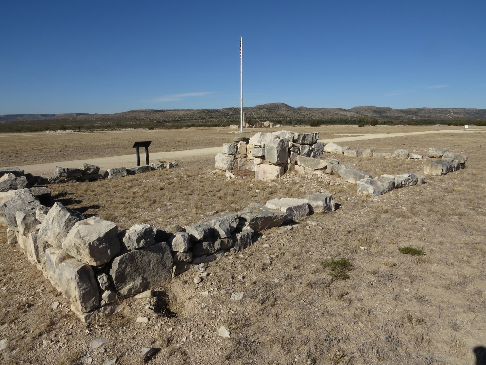


Once the fort was abandoned around 1880 most of the buildings, such as this officer's quarters looking out over the massive parade grounds, were dismantled and the bits carted across the river by the civilians that built the nearby town of Sheffield.


What was once the only Army post in Texas to be actually attacked by the Native Americans that were being displaced from their lands, is now a field littered with remnants, such as these iron bits sitting beside the blacksmith shop, all that's left of a wagon, neatly laid out where they would have fallen as the wood rotted away.


The story of Fort Lancaster, of most of these western forts, is the story of governments expanding their territory, of native peoples dealing with an invasion of their lands, of entrepreneurs finding opportunities, of immigrants that barely speak English enlisting to secure themselves place in this country, of laundresses hauling water from the creek in buckets and scavenging the land for wood to heat that water, then, in the time left over, washing, ironing and mending the clothing of the soldiers, all for $2 per man per month, in order to bring in about $40 per month, (The army allowed 4 laundresses per company, or about 1 for every 20 men) which was more than most could earn elsewhere. (An Army private earned around $32 per month.)

I think that it's important to preserve and visit places like like this, not so we can crow in triumph at what we accomplished, or stomp off in righteous indignation over the atrocities we committed along the way, (Though it does nobody any good to forget either of these.)  but to try and see things in context, to try and understand the motivations and drivers behind events, and to appreciate the personal lives of those living the events. Things that are not always available in textbooks but can only be learned by walking the land and places where our history occurred with an open and empathetic mind. By standing on the same ground, closing your eyes, and letting the ghosts of those that went before give you a little glimpse of the past. Not the sanitized text-book version of the propagandized 60's and 70's when I was in "school", (Columbus discovered America! Yeah right!) not even that black-and-white Hollywood crap we were fed as kids by the boob-tube on Saturdays, but rather the real past as it was lived by those that were there.


Anyway - - -

This is my last full day on the road for this trip. Tomorrow I will get home and start prepping for Thanksgiving coming up in a few days.

But tonight, after I leave the fort, I race the setting sun as far as the I-10 rest area at MP-514.

The westbound rest area here is pretty run of the mill, but the eastbound area is another one of those gems where you can get far from the interstate as well as the parked trucks. (It also has a working dump-station.)

One person stated in a review on the Free Campsites app that it was "nice clean and quiet. Very little truck noise." Then he proceeded to brag about how he parked his 40' fifth-wheel on that quiet back loop, opened the slides, and fired up the generator - an ear-busting contractor generator no doubt.


Fortunately for me, that guy wasn't here tonight.


Monday, July 6, 2020

Critter Crossings in McKittrick Cayon


November 22 2019


While I was messing around on the McKittrick Nature Trail the morning fog lifted up out of the canyon, the main attraction here, so now it's time to quit farting around and get on with the primary hike of the day. And with the looming Thanksgiving holiday chasing me towards home this will be my last hike in Guadalupe Mountains National Park, at least for this trip.

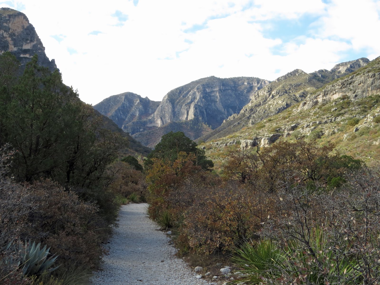
And yes, that trail is very white, but it hasn't been trucked in. The rock and gravel here in the bottom of the canyon, as it is in the bottom of all the "wet" canyons of the park, is naturally this color due to a coat of calcification, so this is what you get when the vegetation is worn away by water or cleared by man.


The destination for this hike is the Hunter Line Shack, about 4 miles up the boomerang-shaped canyon.


Normally tarantulas hide out in burrows during the day, but in the fall, primarily October although this was late November, the males wander around in the daylight looking for love. But it was still pretty chilly when I came across this guy right in the middle of the trail trying to warm up enough to get his groove on.

I suppose the ability to collect moisture on the hairs of your body is a good thing in the desert, but today it just looks like it would make him colder.


McKittrick Canyon is the intersection of a variety of habitats making it a diverse place. Here I was still in the early stages of the hike, in the mouth of canyon where it widens out just before spilling into the Permian Basin.

I was being my usual quiet self, which took some extra care since one of my hiking sticks had suffered a blowout back in the Dragoon mountains (More on that in a later post) which makes it click if not set down carefully, when I heard a bit of a commotion in the scrub and stopped. Moments later these peccaries, or javelins depending on where you're from, decided to cross the road without looking.

Of course the leaders of the pack spotted me right away and, with an extra burst of speed completed the crossing quickly, warning the others, and me, with much clicking of their tusks.

Peccaries have never been successfully domesticated like their close cousins the pig because of their aggressive nature and have been known to kill humans with their short, straight, and very sharp tusks used solely for defense.

But fortunately for me I apparently didn't come across as a particularly dangerous predator and they kept on going.


Soon to be followed, rapidly, by these little ones that, in their haste, were doing their damnedest to avoid actually touching the trail as they flew across.


And in a flash tail-end-Charley was across the trail, clearing the way for me to continue. Though I stayed put for a while just to make sure there wasn't going to be a crossing incident. . .


A little farther along I came across this curious thing. Curious not only because of it's unusual construction, but also because it was clearly too high to be a bench. At this point I wasn't sure what the heck a table made of rock slab and pedestals was doing out here all on it's lonesome.

Further on I came across similar constructions at both the Pratt Lodge and the Grotto, except these also had bench-sized stone constructions next to them.

Not sure what happened to the benches for this table sitting less than a mile from the parking-lot. I'd like to think that people didn't just walk off with them for the hell of it, but - well. . .


Just as the walls closed in and I entered the clutches of the canyon proper the trail crossed McKittrick Creek and here, unlike back at the visitor center, the water is flowing above ground.

This is one of three crossings, one dry not far from the visitor center, this one,


and the third, also wet, prior to reaching Pratt Lodge.

I actually saw small, really small, rainbow trout in some of the deeper pools along here.


After the third crossing, even though I have gained very little elevation since leaving the trailhead, the forest, sheltered here in the deep canyon, starts closing in around the trail


and,though I was a little late for peak color, it's easy to see why this hike is


a favorite in late October - early November for fall color.


It almost went by unnoticed since it's made from native rock, but this rock wall slinking alongside the trail marks the approach to


the short spur to the Pratt Lodge which is located at the confluence of the north and south branches of the McKittrick river.


The lodge is approached through this rather spectacular entry.

First glimpse


Following the spur up and away from the river the lodge gradually

The approach swings around behind the lodge so as to avoid marring the view from the front porch.

appears through the trees.

There are some info-sheets here inside the back door but they didn't photograph well through the wire protecting the glass. One of them is some excerpts from the letter the Pratts sent to the National Park Service describing the location and construction of the lodge.

Front porch facing the river

The lodge was built entirely of wood and stone, including the roof.

Can you imagine being one of the roofers that had to haul those slabs of stone up there and mortar them into place?

More front porch because who wouldn't want to sit here and take it all in?


For many that come up this way the Pratt Lodge is their turnaround point, but there is more to see just a little further up the canyon along the south branch of the river,


though this little guy was reluctant to let me past.

He was small, only old enough to have a single node to his rattle, indicating just one molt so far in his life, but the venom of these little guys is, drop for drop, more potent than that of his elders.

I would have just gone on around him but he was sitting in the middle of the trail and I could hear a group of hikers coming up behind me and was concerned that they may not notice him.

A valid concern since, despite standing right smack-dab in the middle of the trail as I guarded over him and cautioning the hikers as they approached, I had to throw up a hiking stick to keep the dad, completely oblivious of the situation and apparently thinking I was just being difficult, from just plowing on by and stepping on him.

After shepherding the family-group safely past I hung back with the serpent for a while. Not because he needed anymore protection, once disturbed he proved was perfectly capable of moving out of the way on his own and finding a better sunning spot, but to regain some personal space since those hikers were going the same direction I was.


But I was content to make my way slowly through this engaging landscape while they plowed on hastily, and noisily, almost like they were paying by the hour to be out here.


About a mile and a quarter beyond the Pratt Lodge there is a choice to make. The McKittrick Canyon Trail continues in one direction while the Grotto and, a little ways beyond that, the Hunter's Cabin are off to the left down a short stub of trail.


There's a reason I chose the McKittrick Canyon Trail over the Permian Reef Geology Trail, and it's pretty much the same reason I chose the Grotto spur over continuing on up the Canyon Trail.

And again, when I say up I mean up in the literal sense.

So far on this trail I've barely climbed 200', but those in the know generally agree that this next 1.25 mile stretch of trail is the toughest in the park. Mostly because in that 1.25 miles it climbs over 2200' on a trail with some rather dicey sections.

An interesting challenge, but - well, maybe another day. . .


Shortly after taking the easy path I come to the Grotto.

A sort of above-ground cave formed by water seeping down through the limestone above into a funnel-shaped opening that runs about 15 feet back into the mountain.

I couldn't get a photo of the insides because - well, remember that family that passed me? They were now all crammed into the depths of the Grotto and showed no sign of leaving. And when I came back this way later, a young and rather amorous couple, officially a pair of  teenisamoris, had taken up what appeared to be a long-term residence in the same spot.


But in case I was willing to wait for who knows how long for them to get over themselves, there are a couple of those beefy stone tables here at the Grotto.


And finally, I'm at what amounts to the end of the trail. At least this bit of trail.


The Hunter Line Cabin, also built by the Pratts of stone and wood.


Again, I couldn't get inside the building, but who needs to with a porch like this?


I had a perfect place for lunch


and asking for a better view would just be greedy.


Monday, June 29, 2020

Enough With the Bad! Let's Find the Good!


The current times are challenging!

More for some than others.

And I acknowledge (Which I'm trying to do without being smug about it - but normally I have so little to be smug about in the social life-style realm, so it's hard not to.) that I fit firmly in the latter group - you know - the "others".

After all, it's not like I sat around a table playing cards every second Wednesday while indiscriminately sharing a bowl full of Chex-mix, or gathered with friends in a too-crowded booth at the local watering hole most Friday evenings before all this pandemic stuff happened. Prior to February of this year you would have been hard pressed to find me at a parade, or amusement park, or mall, or any other place with more than a handful of people, so not being able to get out there and do that sort of stuff today is no skin off my nose.

We're blessed out here with a decent-sized, isolated bit of property where we can roam without fear of encountering any of the dreaded infected. (At this point in time everybody, including us, should be considered as infected, whether showing symptoms or not.)

And when this all kicked off we didn't have jobs to lose. We didn't run out of toilet paper and disinfectants. We weren't caught short on basic food supplies, or even masks and hand-sanitizer. (Still haven't had to buy any of the latter two items.) That's because we are always stocked up and prepared for a disruption in our oh-so fragile manufacturing and distribution network to ensure that we can just sit back, stay home and keep out of the way during the panic buying phase that is inevitable.

But! (OK, cue the teeny-tiny violin because here comes the whining) It hasn't been all sunshine, peaches, and pealed grapes either. I have, after all, missed the entire spring camping season. (Which means The Wife has had to put up with me being home the whole time, and that's no picnic for her either!) And I'm not going to be surprised if my summer plans and next fall's camping season are trashed as well. Hell, at this point I'm not even going to be surprised if next winter-spring are also a bust, traveling wise. Devastated yes, surprised, no.

But there is some good to be found in all this.


For instance, because of The Virus (I can say that now and everyone knows what I'm talking about, but in 5 years it may be too ambiguous. We can hope anyway!) I can show off the splendid results of my extensive beauty regime without compromising my social-media security!!

(Hummm. Maybe I should have put on my go-to-town hat. That ragged-out barn hat is riding a little low on my ears there. . .)


Monday, June 22, 2020

Guadalupe Mountains: McKittrick Canyon Nature Trail


Guadalupe Mountains National Park is technically interconnected with a web of back-country trails, but it's a long ways to walk over these mountains from one end of the park to the other, so functionally the park is split into three main zones.

Pine Springs, in green, is the easiest to reach and the most visited, Dog Canyon, in yellow, is the most remote, and McKittric Canyon, in blue is a day-use only area.

I've already written several posts from the Pine Springs area, so far I have no firsthand knowledge of the Dog Canyon area, but now I'm going to venture into the McKittrick Canyon "zone".for a couple posts.


Getting here is pretty easy - once the gate finally opens at 0800 mountain time that is.

From Pine Springs turn left on US-62, drive down the north side of the pass about 7 miles, (Slowly in pretty dense fog the day I did this.) passing the Nickle Creek Station, which may have been a "station" in the past but now is the scattered infrastructure of the Ligon Ranch, wait in the north-bound median turn lane until the ranger comes by and unlocks the gate across McKittrick Canyon Road because there isn't enough room in front of the gate for both of you, (0800 is pretty late for me and I had already killed all the time back at camp that I could stand this morning and apparently my watch was running faster than the ranger's) then it's another 4 miles up a narrow but paved road to the McKittrick Canyon Visitor Center.

By the way, don't forget that the gate is locked again at 1630 (4:30) because finding yourself on the wrong side of it is serious business. There is a full page of instructions posted back at the visitor center on what to do if you get locked in. It starts with calling 911 which will connect you to a call center in the next county, they will then call the Culberson County sheriffs office, who will then contact the on-call - - - well, you get the idea.


Apparently people have been living here in this canyon for at least some 12,000 years, and from the 1500's until they were carted off like so much cattle to the reservation northeast of Alamogordo NM the Mescalero Apache called the place home, but today the canyon is named for a rancher that showed up around 1870, even though the most notable "modern" remains to be found in the canyon today are attributable to Wallace Pratt who, after a 100 mile "road-less trek" from Pecos TX, first saw the place in 1921.

By the 1930's Pratt had started buying land and built a stone and timber cabin up the canyon where the north and south McKittrick rivers come together, as well as a hunters cabin up there a few miles further.

When I got here, on a Friday morning, the Visitor Center Office, with a sign saying "ask here if you have questions" was shuttered and locked, but if you go through the breezeway between the office on the right and the bathrooms (Flush toilets) on the left, there is a covered seating area back there and if you push the button below the screen tucked in behind the office a 10 minute video of Pratt describing what attracted him to the area, the geology, (that was his profession) and his reasoning behind donating over 5000 acres to the park, will play.

Maybe you will feel different, but I thought it was worth watching and makes a good start to a visit here.


There are three main trails that originate just behind the Visitor Center.

The Permian Reef Trail earns a Strenuous rating for the 2000' climb required.

Since I don't really consider myself a serious geology buff , and the brochure necessary for decoding the interpretive markers along the trail was unobtainable at the unmanned visitor center, I thought that was a better sounding excuse for skipping this trail than pure laziness. So I decided I could focus on the other two trails instead without too much guilt clawing at me.


At barely a mile long (1.3 by the time I quit messing around.) it's debatable whether the Nature Loop qualifies as a trail or a stroll,


but I thought it was worth an hour.


Besides, that would give the fog a little more time to lift out of the canyon before I hiked the longer trail. (OK, OK, so I didn't have to be quite so hard on the ranger showing up a few minutes late to unlock the gate. . .)


The Nature Trail is populated with a lot of information, both geologic and flora/fauna wise.

Don't worry, I won't inflict any more than this one on y'all, I just wanted to show that the plaques are clear and easy to read, which is not always the case after prolonged exposure.

By the way, this was one of the two or three plaques that are this wordy, making them like kryptonite to the easily bored and distracted - you know, like kids - the rest were shorter and more to-the-point.

That's the Visitor Center under the arrow

Though not a difficult trail at all, you will need a pair of functional legs to manage the rocky path and the 200' of elevation change of this nature loop.


I did my usual counterclockwise orienteering which had me returning towards the visitor center down one side of a ravine with views to the northeast but not of the canyon itself,


but I would be on the trail up the canyon soon enough.