 |
| That frost is on the inside of the windshield!! |
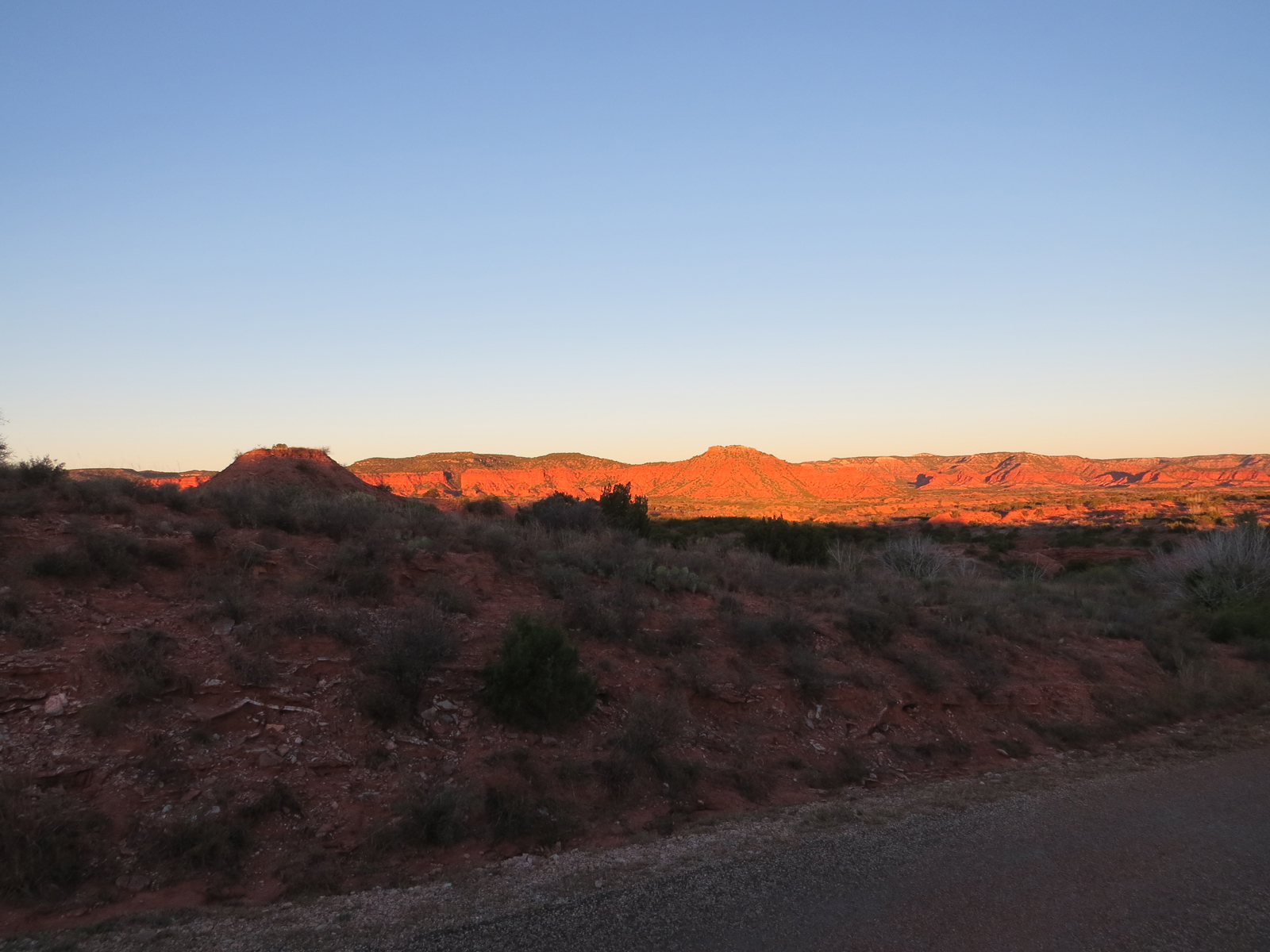
By the third morning the wind had still not settled down, but overnight it had moved around to the north and the southern plains of Texas were in the grips of the season's first blue norther.

One distinct advantage of living in a small space is that it doesn't take much of a heat-source to warm up the inside.
The top number is the inside temp, the bottom number the outside temp. The numbers to the right of each are the high and low since the last 'clear'.
I don't run the heater when I'm sleeping but you can see that my blanket cocooned body was enough to keep the inside temp a solid 20 degrees warmer than outside, (That's right! I'm one hot dude! . . . Oh hell, Even I went into hysterics at that one. . .) and it only took heating water for my oatmeal to add an additional 6 degrees to that. (I knew I was heading out right away so didn't bother with dragging the heater out of it's storage spot.)
The plan today is a slightly ambitious hike on a trail classified as 'very challenging' over there in the northwest corner of the park

but on my way there I made a short side trip up the northern end of the Eagle Point trail to check out a 'bridge' I'd heard about.

It's only a half mile or so from the parking area and less than that from the trailhead itself. Sometimes, such as here, my map shows trails as roads. The road, a narrow, steep curvy one with no shoulders and not recommended for trailers over 15', is that loop that dips down from the top of the image, swoops through and goes right back out the top. What looks like a road running from the bottom of the image, intersecting with the road above, is the trail.

The north winds had blown yesterday's clouds on back to Mexico, but down in the canyon the sun was still struggling to get over the 'horizon' so it was - well - let's say nippy. (Mark of the Box Canyon Blog would be laughing his ass off at me right now if he read this since he considers anything above 10 degrees T-shirt and shorts weather!)

But I was layered up and, though it didn't take long to get to my destination, the activity counteracted the air temp.
This eroded bank clearly shows the layers of soft gypsum sandwiched between equally soft sediment,

and though the trail right there between me and the bench looks pretty solid, and for now it may be,


and it may not be long until the trail, up there on top, will have a gap in it.
For scale, there is enough room there for the mildly athletic, or the youth-delusioned-geezer, to scramble through the arch, but given the size of some of the rocks that have fallen from the underside, I wasn't even slightly tempted. . .

As is usually the case, on the way back to the trailhead the views were different because of veiwing angle and changing light.
That's actually Eagle Point up there, the tailing end of a ridge between Holmes Creek and South Prong Little Red River

and - - - Oh Holy Crap! I left The Van parked underneath that rock up there!!
Sorry, no time to write; gota go save her!
Great photos and if you didn't know where you were it might be hard to realize the photos are of Texas. I wondered what the excuse was going to be for not crawling through that sun filled loop ... LOL. That rock in the last picture looks like it is moments away from rolling down the said of that hill.
ReplyDeleteNo, no crawling through that arch! I may be a fool some of the time, but not all the time. I do have my lucid moments. . .
ReplyDeleteYeah, I didn't notice that larger-than-van sized rock until I turned around and was headed back to The Van. As I hustled back to get her out of harm's way I swear I could hear it starting to slide up there!!