
Copper Breaks is not one of the largest State Parks in Texas, but you can get in a good 15 miles of hiking without doubling too many of the trail sections.

And with maps like this posted at a couple of the major trailheads you would think that the hiking would be simple,
 |
| Another one of my early morning sombra selfies. |

Sure, at first all seems great. You're stepping along with confidence and enjoying the scenery, hardly paying attention to the trail at all,

then this happens!

That seemingly clear sign at the trailhead and the nice wide path are only there to lure you in just far enough, then you're on your own, wondering if that's the trail. . . or maybe it's over there. . . or it could be up there. . .
The reason I took that photo of the map at the trailhead was because just prior to that I had lost the trail, Chris' Link to be precise, classified as an easy, level (Not!) one mile trail where you can 'experience the rolling plains landscape'.
Eventually, having had enough of trying to figure out where the trail is while at the same time slamming into sudden limestone ridges and dropping wheels into hidden gullies when all I wanted was an easy peddle astride the Quad-B for a get-antiquated late-afternoon wander around the park, but not wanting to backtrack either, I ended up bushwacking cross-country, through brush and grasses and tiny, unseen clumps of Cholla-type cactus (I ended up with pants-legs and sock-tops full of the nearly invisible spines.) to where I knew there was a park road. The whole time dragging and horsing the decidedly not bushwhacking-friendly Quad B along with me!
And it wasn't just me.
It just so happened that right after I snapped that shot of the trailhead a young couple burst out of the brush 20 yards to my left. The girl looked around, hustled over to the sign-post, pulled her paper copy of the trail map out of a pocked and started comparing both, trying to figure out where she was. The fella with her had no qualms about utilizing all available resources and asked if I knew where we were.
Upon hearing where they had parked I told them their truck was at the other end of the park, (Oh crap! the girl exclaimed.) and they had about an hour before sunset then another 15 minutes of usable twilight after that. (Oh crap! the girl exclaimed again.)
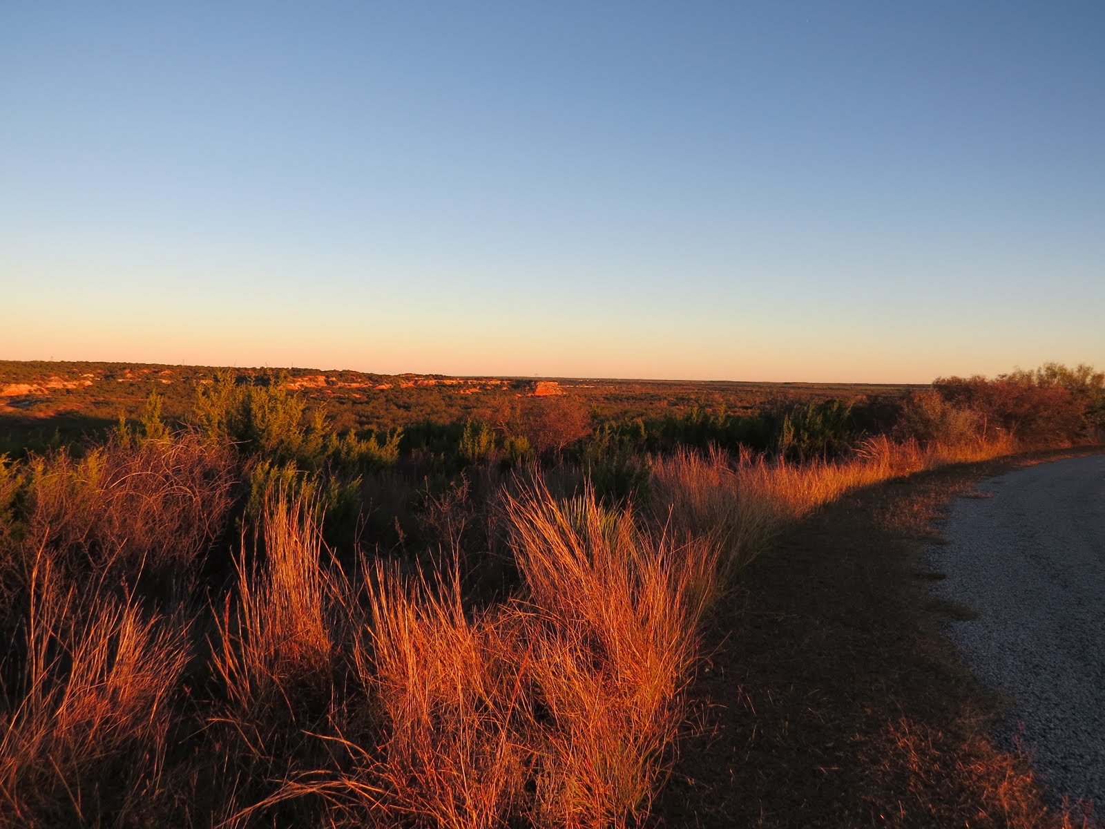
As they hustled off towards their truck, down the easier to follow road this time, I wheeled on up to the Pease River Valley Overlook to wait out that hour till sunset.

Now that I knew where I was relative to where The Van was,

and had confidence in my gear, namely a headlamp, GPS and a map,

I had no qualms about being able to utilize the roads to get back to The Van after dark; and I made it just fine.
But danged if the next day I didn't turn right around and lose another trail!!!

On paper my first hike that day

had all the earmarks of one of my typical hikes.

There was some confusion between the trail sign for Big Loop and the map which called it Long Loop, but come on! If I couldn't figure that out I had no business being out on the trail in the first place!

And the fact that this sign was in 'warning-watch-your-ass' red was slightly disconcerting,

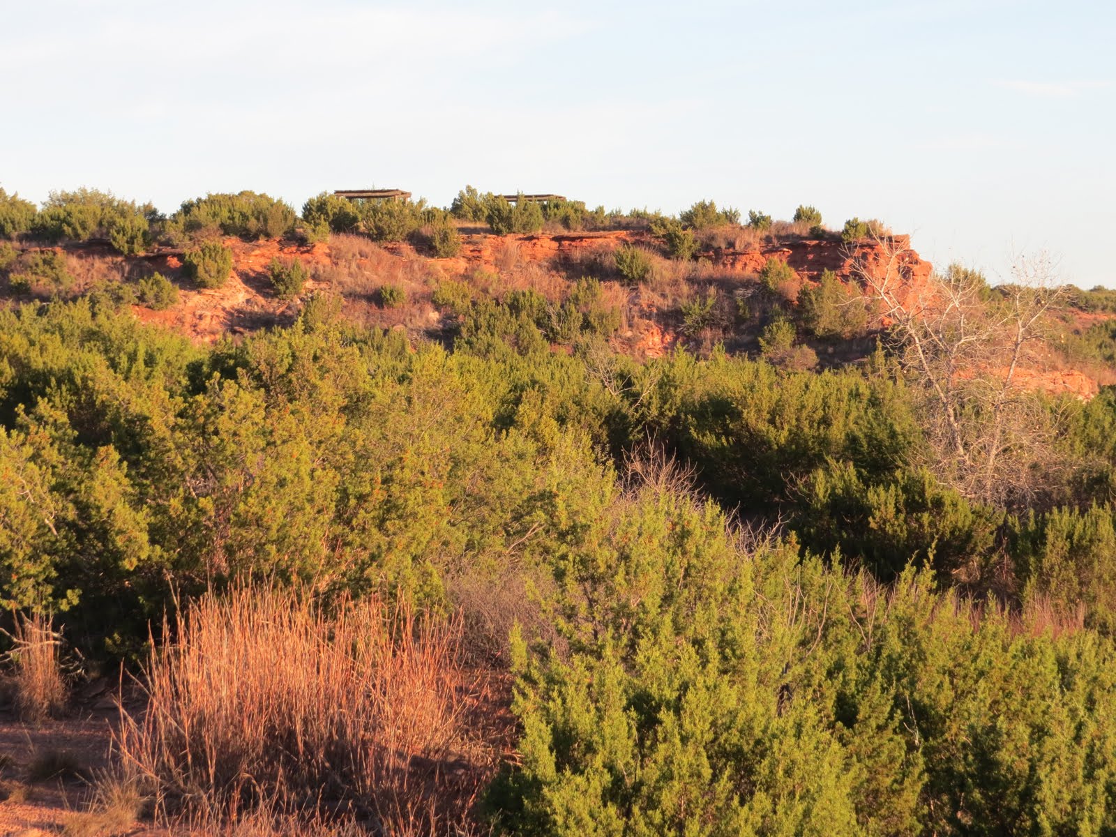
but it was a pleasant hike through some small canyons


with the occasional glimpse of the Pease River down below.

and though they weren't marked as such, I'm pretty sure I found one or two of the old copper mining locations.

Eventually I veered off for a side trip on the Rocky Ridge Loop, and boy was glad I was on foot and not the Quad-B!
 |
| The sign is just in case I couldn't figure out the trial was going to drop steeply in a few feet. |

But then I came to here, this rocky ledge curled in a crescent above the head end of a steep canyon, and I lost the trail. . .

I hunted around for a while but never did figure out where the dang trail went! So I scrambled up the ridge above the ledge then worked my way back down towards the lake, and another trail, through a rather rugged ravine.

By the time I got back to an obvious trail I was kind of perturbed, beginning to seriously doubt my trail-prowess, so headed back and picked up the other end of the Rocky Ledges Loop so I could figure out where I went wrong.
Well foolish me!! Why wouldn't I expect the original trail, a trail designated as a mountain-bike trail, to drop off the ledge right over a 4' abyss and skirt along a rock-face at a 45 degree angle trying it's damnedest to throw me down to the rocks below??!!!

Once I got that sorted out I carefully hunted around but still could find no trail-markers of any kind to steer the hiker into taking a sharp left right over a short cliff, so I took a moment to build a couple cairns in case someone else as clueless as me came along later.

Ah, but you didn't really think this park and it's trails were done with me for the day did you??

After a short break back at camp I allowed myself to be suckered in once more, even though I knew better, by the lure and easy promise of the un-mapped Power Line Trail.

Despite recent experience to the contrary, I cluelessly straddled the Quad-B and set out with the foolish expectation of an easy ride,

but the nice, civilized mowed path soon turned into this,

and then this!
Eventually the trail made it's way up a final steep slope to campsite #39, perched there on the edge of the canyon, in the equestrian camping area (Remember, no horse needed!) where it came out right along side the table-shelter with no indication on that end that there might be an official trail down there below.
All in all, Copper Breaks turned out to be more interesting than the maps would indicate, and I still haven't done any of the trails at the north end of the park!! But those will have to wait for next time since I have an appointment in Abilene.
No comments:
Post a Comment